Approximate Location Map
Large Map »
Latitude: 52.0395 / 52°2'22"N
Longitude: 0.7263 / 0°43'34"E
OS Eastings: 587078
OS Northings: 241409
OS Grid: TL870414
Mapcode National: GBR QHJ.4FQ
Mapcode Global: VHKF3.JZSW
Plus Code: 9F422PQG+RF
Entry Name: 39, Gregory Street
Listing Date: 26 October 1971
Grade: II
Source: Historic England
Source ID: 1180553
English Heritage Legacy ID: 276056
ID on this website: 101180553
Location: Sudbury, Babergh, Suffolk, CO10
County: Suffolk
District: Babergh
Civil Parish: Sudbury
Built-Up Area: Sudbury
Traditional County: Suffolk
Lieutenancy Area (Ceremonial County): Suffolk
Church of England Parish: Sudbury St Gregory with Chilton St Peter
Church of England Diocese: St.Edmundsbury and Ipswich
Tagged with: Building
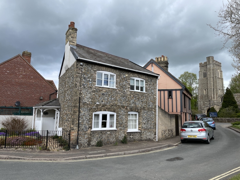
1. GREGORY STREET
1692
(West Side)
No 39
TL 8741 3/187
II GV
2.
Early C19 2 storey 2 window cottage. Flint with Suffolk brick, dressings.
Mainly 3-lights casements with cambered heads, (1 sash window) with glazing
bars. Wood trellis porch at south west corner. Small garden. Corner position.
Nos 39 to 43 (odd) form a group.
Listing NGR: TL8707841409
External links are from the relevant listing authority and, where applicable, Wikidata. Wikidata IDs may be related buildings as well as this specific building. If you want to add or update a link, you will need to do so by editing the Wikidata entry.


Other nearby listed buildings
