Approximate Location Map
Large Map »
Latitude: 52.0369 / 52°2'12"N
Longitude: 0.7256 / 0°43'32"E
OS Eastings: 587044
OS Northings: 241115
OS Grid: TL870411
Mapcode National: GBR QHJ.B82
Mapcode Global: VHKF9.J2GC
Plus Code: 9F422PPG+Q6
Entry Name: Wall Adjoining Trinity House to South
Listing Date: 26 October 1971
Grade: II
Source: Historic England
Source ID: 1180971
English Heritage Legacy ID: 276137
ID on this website: 101180971
Location: Sudbury, Babergh, Suffolk, CO10
County: Suffolk
District: Babergh
Civil Parish: Sudbury
Built-Up Area: Sudbury
Traditional County: Suffolk
Lieutenancy Area (Ceremonial County): Suffolk
Church of England Parish: Sudbury St Gregory with Chilton St Peter
Church of England Diocese: St.Edmundsbury and Ipswich
Tagged with: Wall
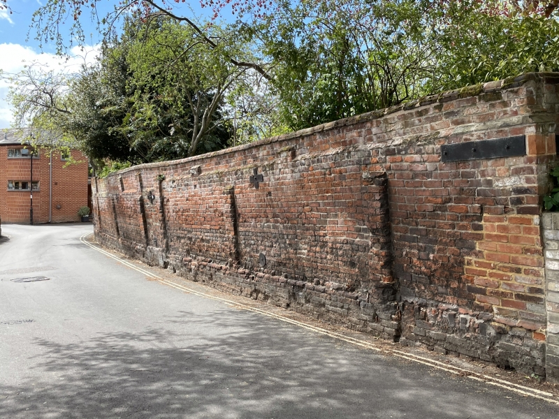
1. SCHOOL STREET
(West Side)
TL 8741 3/226A
II
2.
Wall adjoining to South, probably Cl8 with plinth and piers.
Listing NGR: TL8704441115
External links are from the relevant listing authority and, where applicable, Wikidata. Wikidata IDs may be related buildings as well as this specific building. If you want to add or update a link, you will need to do so by editing the Wikidata entry.


Other nearby listed buildings
