Approximate Location Map
Large Map »
Latitude: 52.0381 / 52°2'17"N
Longitude: 0.7241 / 0°43'26"E
OS Eastings: 586935
OS Northings: 241243
OS Grid: TL869412
Mapcode National: GBR QHJ.3WD
Mapcode Global: VHKF9.H1NF
Plus Code: 9F422PQF+6J
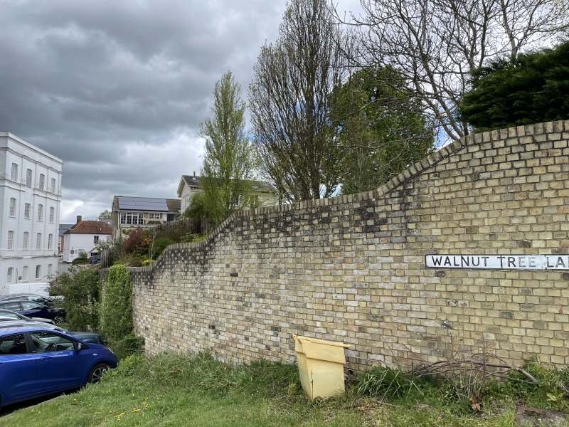
Entry Name: Garden Wall Adjoining Stour Hall West
Listing Date: 26 October 1971
Grade: II
Source: Historic England
Source ID: 1181015
English Heritage Legacy ID: 276147
ID on this website: 101181015
Location: Sudbury, Babergh, Suffolk, CO10
County: Suffolk
District: Babergh
Civil Parish: Sudbury
Built-Up Area: Sudbury
Traditional County: Suffolk
Lieutenancy Area (Ceremonial County): Suffolk
Church of England Parish: Sudbury St Gregory with Chilton St Peter
Church of England Diocese: St.Edmundsbury and Ipswich
Tagged with: Wall
1. STOUR STREET
1692
(North Side)
Garden wall adjoining
Stour Hall west
TL 8741 3/134A
II
2.
High red brick wall west, perhaps Cl8.
Listing NGR: TL8693541243
External links are from the relevant listing authority and, where applicable, Wikidata. Wikidata IDs may be related buildings as well as this specific building. If you want to add or update a link, you will need to do so by editing the Wikidata entry.


Other nearby listed buildings
