Approximate Location Map
Large Map »
Latitude: 52.0605 / 52°3'37"N
Longitude: 0.9756 / 0°58'32"E
OS Eastings: 604084
OS Northings: 244411
OS Grid: TM040444
Mapcode National: GBR SL4.TR8
Mapcode Global: VHKF7.VGNS
Plus Code: 9F423X6G+57
Entry Name: Church of St Mary
Listing Date: 23 January 1958
Grade: I
Source: Historic England
Source ID: 1037438
English Heritage Legacy ID: 276148
ID on this website: 101037438
Location: St Mary's Church, Aldham, Babergh, Suffolk, IP7
County: Suffolk
District: Babergh
Civil Parish: Aldham
Traditional County: Suffolk
Lieutenancy Area (Ceremonial County): Suffolk
Church of England Parish: Aldham
Church of England Diocese: St.Edmundsbury and Ipswich
Tagged with: Church building
ALDHAM CHURCH LANE
1.
5377
Church of St Mary
TM 04 SW 42/1 23.1.58.
I
2.
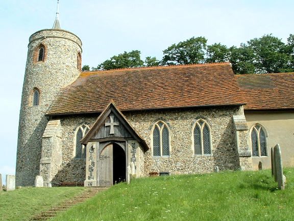
A flint church with stone dressings built circa 1340. A circular west tower
has a C11-C12 base. The chancel has a C14 kingpost roof. There are some
C15 carved benches and a C15 lectern. Most of the pews are C19 or C20 restorations.
Listing NGR: TM0408444411
External links are from the relevant listing authority and, where applicable, Wikidata. Wikidata IDs may be related buildings as well as this specific building. If you want to add or update a link, you will need to do so by editing the Wikidata entry.


Other nearby listed buildings
