Approximate Location Map
Large Map »
Latitude: 52.0428 / 52°2'34"N
Longitude: 0.9537 / 0°57'13"E
OS Eastings: 602660
OS Northings: 242386
OS Grid: TM026423
Mapcode National: GBR SL9.V8D
Mapcode Global: VHKF7.HX1C
Plus Code: 9F422XV3+4F
Entry Name: The Lawns
Listing Date: 22 May 1972
Grade: II
Source: Historic England
Source ID: 1036750
English Heritage Legacy ID: 277765
ID on this website: 101036750
Location: Hadleigh, Babergh, Suffolk, IP7
County: Suffolk
District: Babergh
Civil Parish: Hadleigh
Built-Up Area: Hadleigh
Traditional County: Suffolk
Lieutenancy Area (Ceremonial County): Suffolk
Church of England Parish: Hadleigh St Mary
Church of England Diocese: St.Edmundsbury and Ipswich
Tagged with: Building
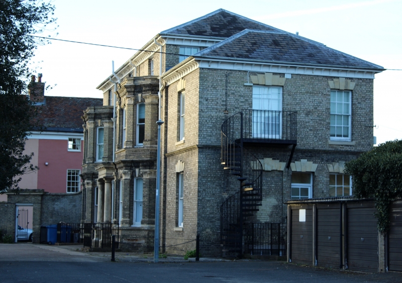
1.
1161
TM 0242
3/157
MARKET PLACE
No 3.
The Lawns.
II
2.
Large C19 Suffolk brick house of 3 storeys. East elevation to Market
Place, 3 storeys. 3 windows with 1 window centre breaking forward under
pediment with circular panel, Stone 2nd floor cill band. Sash windows
with glazing bars. Bracket cornice, NMR photo.
Listing NGR: TM0266042386
External links are from the relevant listing authority and, where applicable, Wikidata. Wikidata IDs may be related buildings as well as this specific building. If you want to add or update a link, you will need to do so by editing the Wikidata entry.


Other nearby listed buildings
