Approximate Location Map
Large Map »
Latitude: 51.9736 / 51°58'25"N
Longitude: 0.7769 / 0°46'36"E
OS Eastings: 590833
OS Northings: 234217
OS Grid: TL908342
Mapcode National: GBR RKP.C6R
Mapcode Global: VHKFJ.FN2C
Plus Code: 9F32XQFG+FQ
Entry Name: Tadworth
Listing Date: 9 February 1978
Grade: II
Source: Historic England
Source ID: 1351767
English Heritage Legacy ID: 277891
ID on this website: 101351767
Location: Bures, Babergh, Suffolk, CO8
County: Suffolk
District: Babergh
Civil Parish: Bures St. Mary
Built-Up Area: Bures
Traditional County: Suffolk
Lieutenancy Area (Ceremonial County): Suffolk
Church of England Parish: Bures St Mary
Church of England Diocese: St.Edmundsbury and Ipswich
Tagged with: Building
HIGH STREET
1.
5377 (North-West Side)
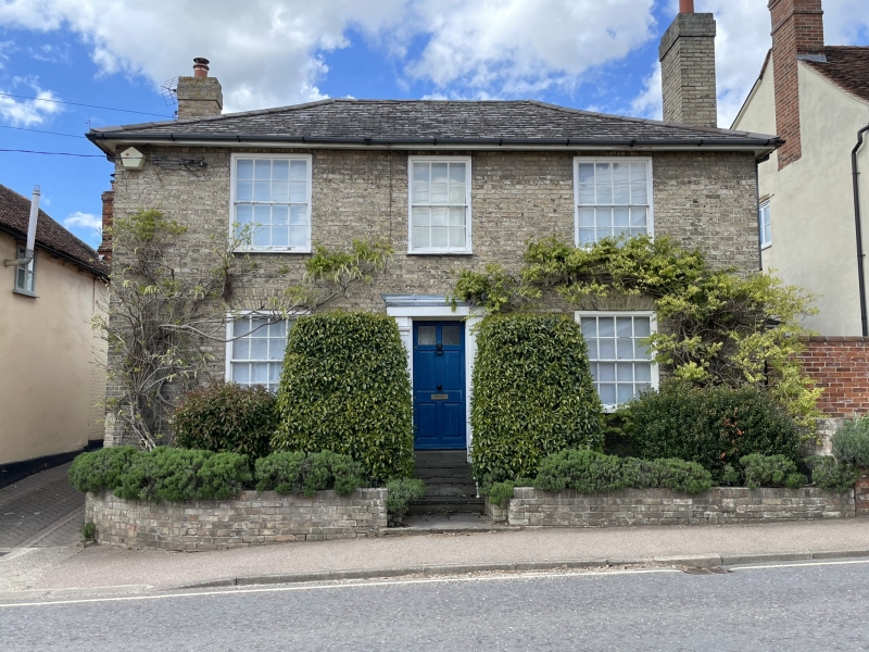
Bures St Mary
Tadworth
TL 9034 26/94
II GV
2.
A mid C19 red brick house with a grey gault brick front. 2 storeys. 3
window range, double-hung sashes with glazing bars, in flush cased frames.
Central doorway. Roof slate hipped. Included for group value.
Listing NGR: TL9083334217
External links are from the relevant listing authority and, where applicable, Wikidata. Wikidata IDs may be related buildings as well as this specific building. If you want to add or update a link, you will need to do so by editing the Wikidata entry.


Other nearby listed buildings
