Approximate Location Map
Large Map »
Latitude: 52.1161 / 52°6'57"N
Longitude: 1.1274 / 1°7'38"E
OS Eastings: 614220
OS Northings: 251033
OS Grid: TM142510
Mapcode National: GBR TM2.9VX
Mapcode Global: VHLBL.H2DM
Plus Code: 9F43448G+CX
Entry Name: Barham Manor
Listing Date: 9 December 1955
Grade: II
Source: Historic England
Source ID: 1033248
English Heritage Legacy ID: 279203
ID on this website: 101033248
Location: Barham, Mid Suffolk, IP6
County: Suffolk
District: Mid Suffolk
Civil Parish: Barham
Traditional County: Suffolk
Lieutenancy Area (Ceremonial County): Suffolk
Church of England Parish: Claydon and Barham St Mary and St Peter
Church of England Diocese: St.Edmundsbury and Ipswich
Tagged with: Manor house
BARHAM CHURCH LANE
TM 15 SW
3/10 Barham Manor
9.12.55
-
II
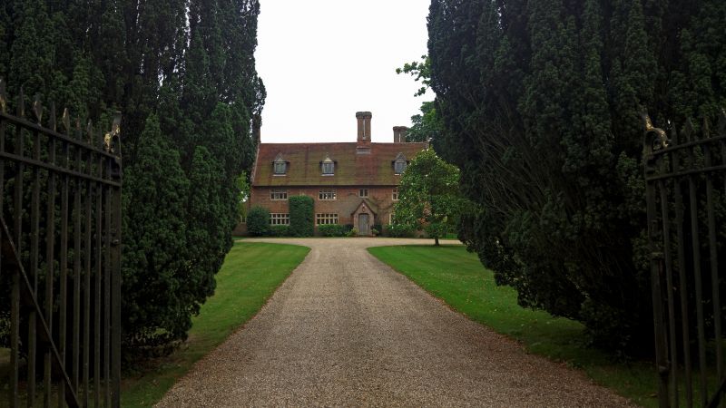
House, formerly manor house. C.1600, with alterations of early C20. Two
storeys and attics. 3-cell lobby-entrance plan. Red brick in irregular
English bond, perhaps originally plastered. Crow-stepped parapet gables.
Plaintiled roofs with original chimneys of red brick; an axial stack between
hall and parlour has a square base and 4 octagonal flues with star-tops. At
the left-hand gable is a similar 2-flue stack; another similar surmounts the
crow-stepped gable of the original rear wing behind the parlour. C20 casement
dormers with gabled roofs. Mainly original mullioned and transomed windows of
plastered brick, simulating limestone, with hollow-chamfered mullions; of 10
lights at ground storey and 8 above, with C20 leaded casements. C20 single-
storey gabled entrance porch of red brick with boarded and battened door. At
1st floor level is a carved limestone coat of arms sunk within a moulded
border. In the parlour the ceiling joists are ovolo-moulded; other exposed
framing is plain. A number of small open fireplaces are original features,
with elliptical heads. The house was altered in early C20 and a wing was
added to rear left.
Listing NGR: TM1422051033
External links are from the relevant listing authority and, where applicable, Wikidata. Wikidata IDs may be related buildings as well as this specific building. If you want to add or update a link, you will need to do so by editing the Wikidata entry.


Other nearby listed buildings
