Approximate Location Map
Large Map »
Latitude: 52.125 / 52°7'30"N
Longitude: 0.4512 / 0°27'4"E
OS Eastings: 567897
OS Northings: 250245
OS Grid: TL678502
Mapcode National: GBR PDP.LXB
Mapcode Global: VHJH3.RVXB
Plus Code: 9F424FG2+2F
Entry Name: 112
Listing Date: 20 May 1974
Grade: II
Source: Historic England
Source ID: 1284751
English Heritage Legacy ID: 283143
ID on this website: 101284751
Location: Great Thurlow, West Suffolk, CB9
County: Suffolk
District: West Suffolk
Civil Parish: Great Thurlow
Traditional County: Suffolk
Lieutenancy Area (Ceremonial County): Suffolk
Church of England Parish: Great Thurlow All Saints
Church of England Diocese: St.Edmundsbury and Ipswich
Tagged with: Building
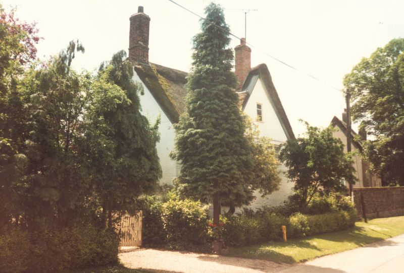
1. GREAT THURLOW GREAT THURLOW
2006
No 112
TL 6750 22/220
TL 6850 22/220
II
GV
2.
A C17 timber-framed and plastered house built on an L shaped plan, with part of
the front faced in bricks, now colourwashed. 2 storeys and attics. Casement windows.
Roof thatched.
Wheatsheaf Cottage, Rose and Crown Public House, Nos 112A and 113A,
No 112 and Post Office and stores form a group.
Listing NGR: TL6789750245
External links are from the relevant listing authority and, where applicable, Wikidata. Wikidata IDs may be related buildings as well as this specific building. If you want to add or update a link, you will need to do so by editing the Wikidata entry.
Other nearby listed buildings


