Approximate Location Map
Large Map »
Latitude: 52.093 / 52°5'34"N
Longitude: 1.318 / 1°19'4"E
OS Eastings: 627380
OS Northings: 249048
OS Grid: TM273490
Mapcode National: GBR WQ5.Q20
Mapcode Global: VHLBP.SNMB
Plus Code: 9F4338V9+65
Entry Name: 19, Thoroughfare
Listing Date: 20 December 1971
Grade: II
Source: Historic England
Source ID: 1377082
English Heritage Legacy ID: 284841
ID on this website: 101377082
Location: Woodbridge, East Suffolk, IP12
County: Suffolk
District: East Suffolk
Civil Parish: Woodbridge
Built-Up Area: Woodbridge
Traditional County: Suffolk
Lieutenancy Area (Ceremonial County): Suffolk
Church of England Parish: Woodbridge St John the Evangelist
Church of England Diocese: St.Edmundsbury and Ipswich
Tagged with: Building
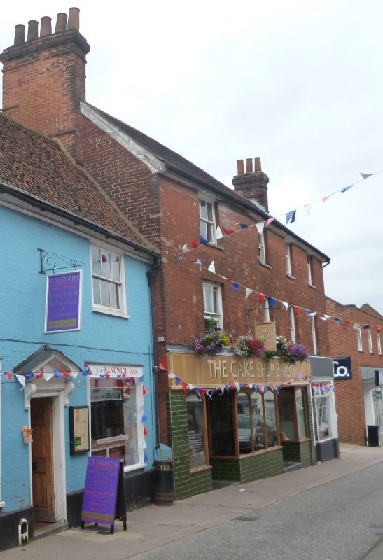
1. THOROUGHFARE
1852 (North Side)
No 19
TM 2748 3/360
II GV
2.
Early C19, 3 storey, red brick. Tiles. 4 windows, sash, with flat
arches, modern glazing. Modern shop fronts.
Nos 13 to 19 (odd) form a group.
Listing NGR: TM2738049048
External links are from the relevant listing authority and, where applicable, Wikidata. Wikidata IDs may be related buildings as well as this specific building. If you want to add or update a link, you will need to do so by editing the Wikidata entry.


Other nearby listed buildings
