Approximate Location Map
Large Map »
Latitude: 52.2196 / 52°13'10"N
Longitude: 1.2655 / 1°15'55"E
OS Eastings: 623153
OS Northings: 262960
OS Grid: TM231629
Mapcode National: GBR VM7.W6N
Mapcode Global: VHLB2.WGDS
Plus Code: 9F436798+R6
Entry Name: Serpentine Wall Immediately North East of the Rookery
Listing Date: 19 November 1984
Grade: II
Source: Historic England
Source ID: 1377286
English Heritage Legacy ID: 285807
ID on this website: 101377286
Location: Earl Soham, East Suffolk, IP13
County: Suffolk
District: East Suffolk
Civil Parish: Earl Soham
Built-Up Area: Earl Soham
Traditional County: Suffolk
Lieutenancy Area (Ceremonial County): Suffolk
Church of England Parish: Earl Soham St Mary
Church of England Diocese: St.Edmundsbury and Ipswich
Tagged with: Wall
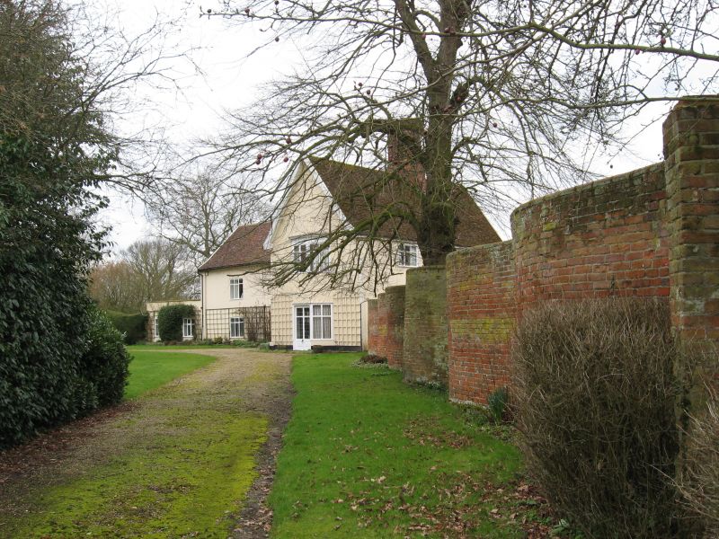
TM 26 SW EARL SOHAM BRANDESTON ROAD
8/35 Serpentine wall
- immediately
north east of
The Rookery
GV II
Serpentine wall. C18. Red brick, c.30m long and c.2.5m high.
Lower part random bond, upper part stretcher bond and only one
brick thick.
Listing NGR: TM2315362960
External links are from the relevant listing authority and, where applicable, Wikidata. Wikidata IDs may be related buildings as well as this specific building. If you want to add or update a link, you will need to do so by editing the Wikidata entry.


Other nearby listed buildings
