Approximate Location Map
Large Map »
Latitude: 51.4635 / 51°27'48"N
Longitude: -2.5061 / 2°30'22"W
OS Eastings: 364935
OS Northings: 173961
OS Grid: ST649739
Mapcode National: GBR CWG.Y6
Mapcode Global: VH88P.HGZX
Plus Code: 9C3VFF7V+CG
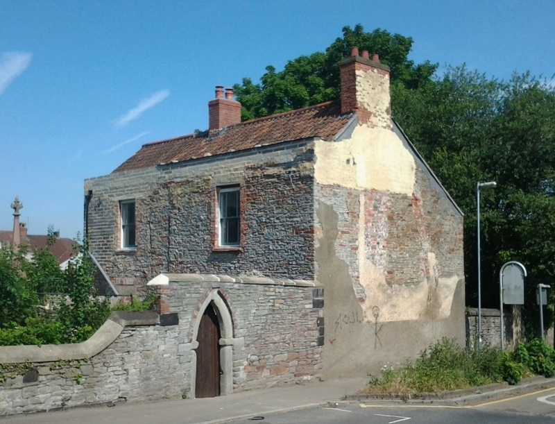
Entry Name: Chapel House
Listing Date: 15 July 1981
Grade: II
Source: Historic England
Source ID: 1320047
English Heritage Legacy ID: 28739
ID on this website: 101320047
Location: Potterswood, South Gloucestershire, BS15
County: South Gloucestershire
Parish: Non Civil Parish
Built-Up Area: Bristol
Traditional County: Gloucestershire
Lieutenancy Area (Ceremonial County): Gloucestershire
Church of England Parish: Kingswood
Church of England Diocese: Bristol
Tagged with: House
1.
5118 EX-KINGWOOD UD PARK ROAD
(west side)
Chapel House
ST 6473 9/174
II GV
2.
Early C19. Rendered with pantile roof. Two storeys. Front to south.
Two windows, mid-C19 sashes, central panelled door in arched recess. Associated
with Whitfield's Tabernacle.
Listing NGR: ST6493473962
External links are from the relevant listing authority and, where applicable, Wikidata. Wikidata IDs may be related buildings as well as this specific building. If you want to add or update a link, you will need to do so by editing the Wikidata entry.


Other nearby listed buildings
