Approximate Location Map
Large Map »
Latitude: 51.2359 / 51°14'9"N
Longitude: -0.205 / 0°12'18"W
OS Eastings: 525406
OS Northings: 150057
OS Grid: TQ254500
Mapcode National: GBR JJ0.GYY
Mapcode Global: VHGS9.D6GC
Plus Code: 9C3X6QPV+9X
Entry Name: Garden Wall of Reigate Priory
Listing Date: 31 March 1977
Grade: II
Source: Historic England
Source ID: 1029138
English Heritage Legacy ID: 289280
ID on this website: 101029138
Location: Reigate, Reigate and Banstead, Surrey, RH2
County: Surrey
District: Reigate and Banstead
Electoral Ward/Division: Reigate Central
Parish: Non Civil Parish
Built-Up Area: Reigate
Traditional County: Surrey
Lieutenancy Area (Ceremonial County): Surrey
Church of England Parish: Reigate
Church of England Diocese: Southwark
Tagged with: Wall
BELL STREET
1.
5388
(West Side)
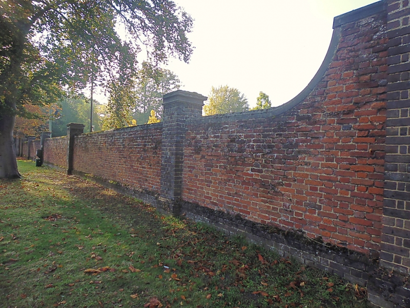
Garden Wall of
Reigate Priory
TQ 2549 NW 16/127
TQ 2550 SW 12/127
II
S2.
Red brick wall, probably C18, with buttresses on the inside and pilasters at
intervals on the outside. At the south end 3 ogee-headed arches, 2 of them
blocked.
Listing NGR: TQ2540650057
External links are from the relevant listing authority and, where applicable, Wikidata. Wikidata IDs may be related buildings as well as this specific building. If you want to add or update a link, you will need to do so by editing the Wikidata entry.


Other nearby listed buildings
