Approximate Location Map
Large Map »
Latitude: 51.2341 / 51°14'2"N
Longitude: -0.2904 / 0°17'25"W
OS Eastings: 519450
OS Northings: 149715
OS Grid: TQ194497
Mapcode National: GBR HGK.KCY
Mapcode Global: VHGS7.X7BR
Plus Code: 9C3X6PM5+MR
Entry Name: 26, the Borough
Listing Date: 11 June 1973
Grade: II
Source: Historic England
Source ID: 1028912
English Heritage Legacy ID: 289849
ID on this website: 101028912
Location: Brockham, Mole Valley, Surrey, RH3
County: Surrey
District: Mole Valley
Civil Parish: Brockham
Built-Up Area: Brockham
Traditional County: Surrey
Lieutenancy Area (Ceremonial County): Surrey
Church of England Parish: Brockham Green Christ Church
Church of England Diocese: Southwark
Tagged with: Building
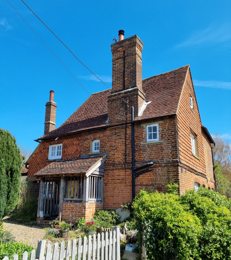
THE BOROUGH, BROCKHAM
1.
1049
No 26
TQ 14 NE 10/119
II
2.
C17. Small timber-framed cottage refronted with red brick but the timber-
framing with brick infilling visible in the east wall. Tiled roof. Chimney
breast at the west end. Casement windows. Modern porch. 2 storeys. 3
windows. Photograph in NMR.
Listing NGR: TQ1945049715
External links are from the relevant listing authority and, where applicable, Wikidata. Wikidata IDs may be related buildings as well as this specific building. If you want to add or update a link, you will need to do so by editing the Wikidata entry.


Other nearby listed buildings
