Approximate Location Map
Large Map »
Latitude: 51.2328 / 51°13'57"N
Longitude: -0.2846 / 0°17'4"W
OS Eastings: 519859
OS Northings: 149572
OS Grid: TQ198495
Mapcode National: GBR HGL.LVP
Mapcode Global: VHGS8.08WT
Plus Code: 9C3X6PM8+44
Entry Name: The Village Pound
Listing Date: 11 June 1973
Grade: II
Source: Historic England
Source ID: 1028917
English Heritage Legacy ID: 289856
ID on this website: 101028917
Location: Brockham, Mole Valley, Surrey, RH3
County: Surrey
District: Mole Valley
Civil Parish: Brockham
Built-Up Area: Brockham
Traditional County: Surrey
Lieutenancy Area (Ceremonial County): Surrey
Church of England Parish: Brockham Green Christ Church
Church of England Diocese: Southwark
Tagged with: Building
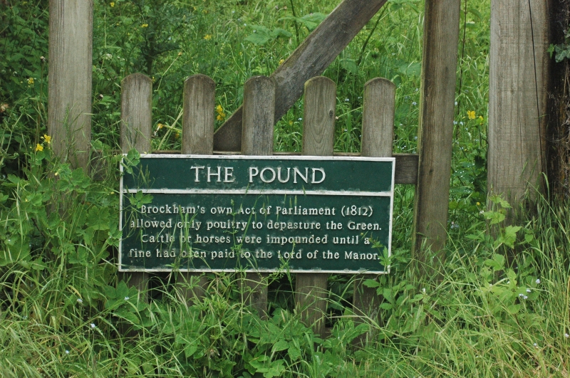
BROCKHAM GREEN, BROCKHAM
1.
1049
The Village Pound
TQ14 NE 10/129
II
2.
Situated near the north-eastern entrance to the Green. Small square enclosure
formed by a red brick wall with an opening on the west side flanked by brick
piers.
Listing NGR: TQ1985949572
External links are from the relevant listing authority and, where applicable, Wikidata. Wikidata IDs may be related buildings as well as this specific building. If you want to add or update a link, you will need to do so by editing the Wikidata entry.


Other nearby listed buildings
