Approximate Location Map
Large Map »
Latitude: 51.1764 / 51°10'34"N
Longitude: -0.3713 / 0°22'16"W
OS Eastings: 513948
OS Northings: 143162
OS Grid: TQ139431
Mapcode National: GBR HH7.2YJ
Mapcode Global: VHFVY.JP2K
Plus Code: 9C3X5JGH+GF
Entry Name: Leith Hill Tower
Listing Date: 11 November 1966
Grade: II
Source: Historic England
Source ID: 1028808
English Heritage Legacy ID: 290087
ID on this website: 101028808
Location: Mole Valley, Surrey, RH5
County: Surrey
District: Mole Valley
Civil Parish: Wotton
Traditional County: Surrey
Lieutenancy Area (Ceremonial County): Surrey
Church of England Parish: Coldharbour
Church of England Diocese: Guildford
Tagged with: Building
WOTTON C.P. LEITH HILL
TQ 14SW
6/124 Leith Hill Tower
11/11/66
II
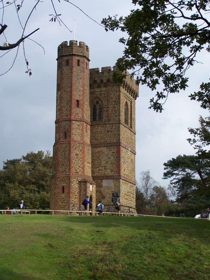
Folly Tower. Built as a landmark in 1764 or 65 by Richard Hulls of Leith Hill
Place, although dated on fabric, 1766, after faulty restoration of inscription.
Tower restored and heightened by William Philip Perrin of Tanhurst. Further
restored and battlements and stair turret added in 1864 by William John Evelyn
of Wotton House. Bargate stone rubble with brick dressings and mouldings.
Square plan. Battering Tower with roll moulding, four stages above separated
by brick plat bands, upper stage with stone string course and brick angle quoins.
Corbelled and battlemented parapet to top stage. Octagonal stair turret at north
west corner of four stages, offset, and with battlemented top. Rectangular
lancet fenestration with door in south face. West face of tower has arch on
impost blocks to lowest stage, roundel above. Two light and roundel plate tracery
window in panel to top stage in each face. Richard Hulls was buried below the
lower room of the original two room tower in 1772. The tower stands on the
highest point in the County of Surrey and reputedly it is possible to see 13
Counties from its battlements.
Listing NGR: TQ1394843162
External links are from the relevant listing authority and, where applicable, Wikidata. Wikidata IDs may be related buildings as well as this specific building. If you want to add or update a link, you will need to do so by editing the Wikidata entry.


Other nearby listed buildings
