Approximate Location Map
Large Map »
Latitude: 50.9159 / 50°54'57"N
Longitude: 0.4857 / 0°29'8"E
OS Eastings: 574828
OS Northings: 115875
OS Grid: TQ748158
Mapcode National: GBR PWF.HM9
Mapcode Global: FRA C6XP.72V
Plus Code: 9F22WF8P+87
Entry Name: The Gateway
Listing Date: 3 August 1961
Grade: II
Source: Historic England
Source ID: 1044190
English Heritage Legacy ID: 292169
ID on this website: 101044190
Location: Battle, Rother, East Sussex, TN33
County: East Sussex
District: Rother
Civil Parish: Battle
Built-Up Area: Battle
Traditional County: Sussex
Lieutenancy Area (Ceremonial County): East Sussex
Church of England Parish: Battle St Mary the Virgin
Church of England Diocese: Chichester
Tagged with: Building
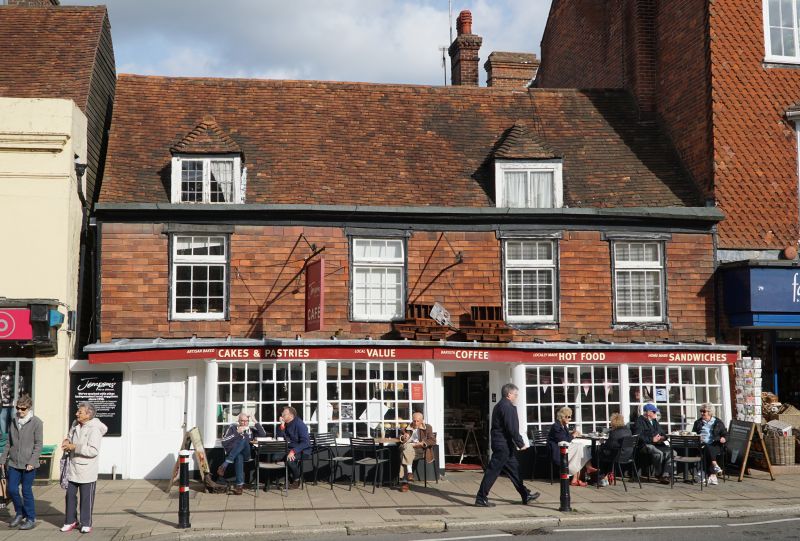
TQ 7415-7515 BATTLE HIGH STREET
(north east side)
41/36 No 78 (The Gateway)
3.8.61
GV II
C17 building, refaced in the C18. Two storeys and attic. Four windows. Two
dormers. Now tile-hung. Moulded wooden eaves cornice. Tiled roof. Modern shop
front with cornice over.
Listing NGR: TQ7483015876
External links are from the relevant listing authority and, where applicable, Wikidata. Wikidata IDs may be related buildings as well as this specific building. If you want to add or update a link, you will need to do so by editing the Wikidata entry.


Other nearby listed buildings
