Approximate Location Map
Large Map »
Latitude: 50.845 / 50°50'41"N
Longitude: 0.0884 / 0°5'18"E
OS Eastings: 547122
OS Northings: 107129
OS Grid: TQ471071
Mapcode National: GBR LRP.Z0Y
Mapcode Global: FRA C62V.VMW
Plus Code: 9F22R3VQ+X9
Entry Name: The Parish Church of St Peter
Listing Date: 20 August 1965
Grade: I
Source: Historic England
Source ID: 1043939
English Heritage Legacy ID: 292892
ID on this website: 101043939
Location: St Peter's Church, Firle, Lewes, East Sussex, BN8
County: East Sussex
District: Lewes
Civil Parish: Firle
Traditional County: Sussex
Lieutenancy Area (Ceremonial County): East Sussex
Church of England Parish: West Firle St Peter
Church of England Diocese: Chichester
Tagged with: Church building
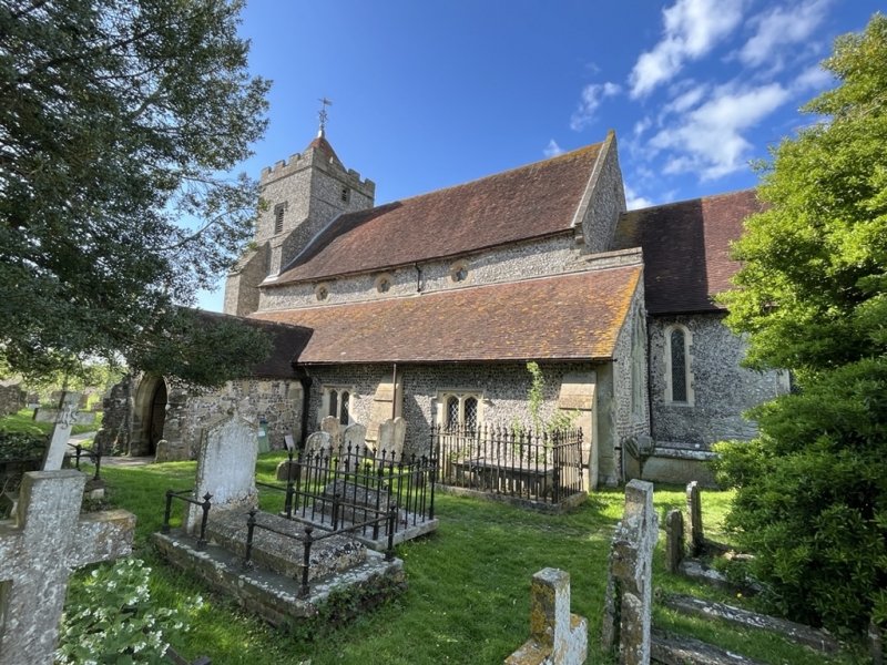
FIRLE
1.
5206
The Parish Church of
St Peter
TQ 4707 33/482 20.8.65.
I
2.
Church of England. Chancel with north or Gage chapel, now the vestry, nave
with aisles, south porch and west tower. Chancel C13, the remainder C14.
The Gage chapel contains brasses and monuments to the members of the Gage family
of Firle Place.
Listing NGR: TQ4712807128
External links are from the relevant listing authority and, where applicable, Wikidata. Wikidata IDs may be related buildings as well as this specific building. If you want to add or update a link, you will need to do so by editing the Wikidata entry.


Other nearby listed buildings
