Approximate Location Map
Large Map »
Latitude: 50.8079 / 50°48'28"N
Longitude: 0.1567 / 0°9'24"E
OS Eastings: 552051
OS Northings: 103149
OS Grid: TQ520031
Mapcode National: GBR LSC.BFK
Mapcode Global: FRA C66Y.QWD
Plus Code: 9F22R554+5M
Entry Name: The Manor House
Listing Date: 13 October 1952
Grade: II
Source: Historic England
Source ID: 1353263
English Heritage Legacy ID: 294898
ID on this website: 101353263
Location: Alfriston, Wealden, East Sussex, BN26
County: East Sussex
District: Wealden
Civil Parish: Alfriston
Built-Up Area: Alfriston
Traditional County: Sussex
Lieutenancy Area (Ceremonial County): East Sussex
Church of England Parish: Alfriston with Lullington
Church of England Diocese: Chichester
Tagged with: House
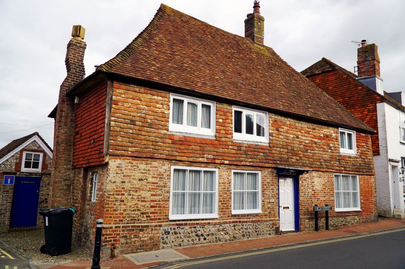
ALFRISTON HIGH STREET
1.
5208
(east side)
The Manor House
TQ 5203 39/55 13.10.52
II GV
2.
C17 or earlier. Two storeys. Three windows. Ground floor red brick on
a flint base, above tile-hung. Hipped tiled roof. Casement windows. Doorway
with flat hood on brackets.
Listing NGR: TQ5204903151
External links are from the relevant listing authority and, where applicable, Wikidata. Wikidata IDs may be related buildings as well as this specific building. If you want to add or update a link, you will need to do so by editing the Wikidata entry.


Other nearby listed buildings
