Approximate Location Map
Large Map »
Latitude: 50.8889 / 50°53'20"N
Longitude: 0.2467 / 0°14'48"E
OS Eastings: 558120
OS Northings: 112339
OS Grid: TQ581123
Mapcode National: GBR MSV.36K
Mapcode Global: FRA C6DR.HXQ
Plus Code: 9F22V6QW+HM
Entry Name: Priors Grange
Listing Date: 30 August 1966
Grade: II
Source: Historic England
Source ID: 1194708
English Heritage Legacy ID: 295249
ID on this website: 101194708
Location: Lower Horsebridge, Wealden, East Sussex, BN27
County: East Sussex
District: Wealden
Civil Parish: Hellingly
Traditional County: Sussex
Lieutenancy Area (Ceremonial County): East Sussex
Church of England Parish: Hellingly St Peter and St Paul
Church of England Diocese: Chichester
Tagged with: Building
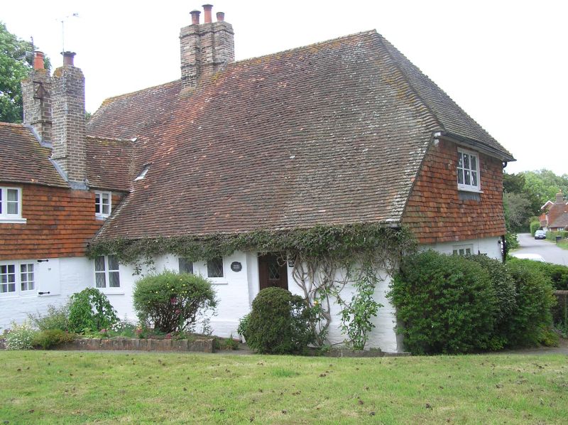
HELLINGLY CHURCH PATH
1.
5208
No 7
(Priors Grange)
TQ 5812 33/603 30.8.66
II GV
2.
This backs onto the churchyard but faces the road. C17 or earlier. Two
storeys. Four windows. Tile-hung. Hipped tiled roof. Casement windows.
Listing NGR: TQ5812212340
External links are from the relevant listing authority and, where applicable, Wikidata. Wikidata IDs may be related buildings as well as this specific building. If you want to add or update a link, you will need to do so by editing the Wikidata entry.


Other nearby listed buildings
