Approximate Location Map
Large Map »
Latitude: 51.0965 / 51°5'47"N
Longitude: 0.2701 / 0°16'12"E
OS Eastings: 559053
OS Northings: 135475
OS Grid: TQ590354
Mapcode National: GBR MQC.34B
Mapcode Global: FRA C6G7.11V
Plus Code: 9F3237WC+J2
Entry Name: The Victoria Well
Listing Date: 31 December 1982
Grade: II
Source: Historic England
Source ID: 1286674
English Heritage Legacy ID: 296197
ID on this website: 101286674
Location: Frant, Wealden, East Sussex, TN3
County: East Sussex
District: Wealden
Civil Parish: Frant
Built-Up Area: Frant
Traditional County: Sussex
Lieutenancy Area (Ceremonial County): East Sussex
Church of England Parish: Frant with Eridge
Church of England Diocese: Chichester
Tagged with: Well
FRANT THE GREEN
1.
5208
(north-east side)
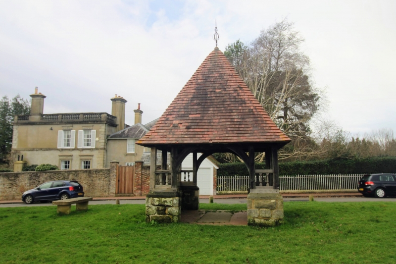
The Victoria Well
TQ 5935 35/298
II
2.
C19 covering to a former well. Rectangular enclosure of a stone base surmounted
by a wooden railing with uprights supporting a pyramidical tiled roof.
The well itself has been covered in by a fixed flagstone.
Listing NGR: TQ5905335475
External links are from the relevant listing authority and, where applicable, Wikidata. Wikidata IDs may be related buildings as well as this specific building. If you want to add or update a link, you will need to do so by editing the Wikidata entry.


Other nearby listed buildings
