Approximate Location Map
Large Map »
Latitude: 51.096 / 51°5'45"N
Longitude: 0.2677 / 0°16'3"E
OS Eastings: 558887
OS Northings: 135410
OS Grid: TQ588354
Mapcode National: GBR MQC.8HH
Mapcode Global: FRA C6G7.049
Plus Code: 9F3237W9+93
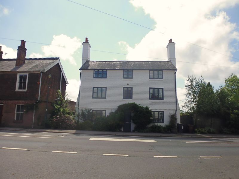
Entry Name: The White House
Listing Date: 31 December 1982
Grade: II
Source: Historic England
Source ID: 1353514
English Heritage Legacy ID: 296209
ID on this website: 101353514
Location: Frant, Wealden, East Sussex, TN3
County: East Sussex
District: Wealden
Civil Parish: Frant
Built-Up Area: Frant
Traditional County: Sussex
Lieutenancy Area (Ceremonial County): East Sussex
Church of England Parish: Frant with Eridge
Church of England Diocese: Chichester
Tagged with: House
FRANT THE GREEN
1.
5208
(west side)
The White House
TQ 5835 35/309
II
2.
C18. Three storeys. Three windows. Ground floor brick, above tile-hung, both
now painted, with brick cogging between. Slate roof. Casement windows. Doorway
with flat hood on brackets and door of 6 fielded panels.
Listing NGR: TQ5888735410
External links are from the relevant listing authority and, where applicable, Wikidata. Wikidata IDs may be related buildings as well as this specific building. If you want to add or update a link, you will need to do so by editing the Wikidata entry.


Other nearby listed buildings
