Approximate Location Map
Large Map »
Latitude: 51.1184 / 51°7'6"N
Longitude: 0.1197 / 0°7'10"E
OS Eastings: 548452
OS Northings: 137588
OS Grid: TQ484375
Mapcode National: GBR LNG.T7Z
Mapcode Global: VHHQJ.1540
Plus Code: 9F324499+8V
Entry Name: Perryhill Farmhouse
Listing Date: 31 December 1982
Grade: II
Source: Historic England
Source ID: 1286579
English Heritage Legacy ID: 296284
ID on this website: 101286579
Location: Wealden, East Sussex, TN7
County: East Sussex
District: Wealden
Civil Parish: Hartfield
Traditional County: Sussex
Lieutenancy Area (Ceremonial County): East Sussex
Church of England Parish: Hartfield St Mary
Church of England Diocese: Chichester
Tagged with: Farmhouse
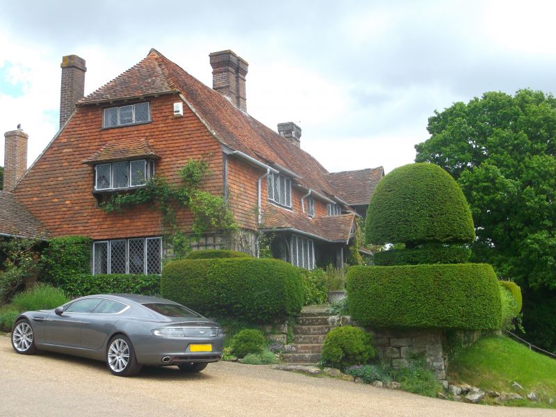
HARTFIELD Perryhill Farmhouse
1.
5208
TQ 43 NE 5/88
II
2.
Late C16 or early C17 timber-framed house, restored and enlarged and now
faced with red brick and stone on ground floor and tile-hung above. Tiled
roof. Casement windows. Gable and 2 bays built out. Two storeys. Four
windows.
Listing NGR: TQ4845237588
External links are from the relevant listing authority and, where applicable, Wikidata. Wikidata IDs may be related buildings as well as this specific building. If you want to add or update a link, you will need to do so by editing the Wikidata entry.


Other nearby listed buildings
