Approximate Location Map
Large Map »
Latitude: 51.0206 / 51°1'14"N
Longitude: 0.2647 / 0°15'52"E
OS Eastings: 558934
OS Northings: 127022
OS Grid: TQ589270
Mapcode National: GBR MR4.V26
Mapcode Global: FRA C6FF.4Y1
Plus Code: 9F3227C7+6V
Entry Name: Pound Hill House
Listing Date: 31 December 1982
Grade: II
Source: Historic England
Source ID: 1028211
English Heritage Legacy ID: 296506
ID on this website: 101028211
Location: Mayfield, Wealden, East Sussex, TN20
County: East Sussex
District: Wealden
Civil Parish: Mayfield and Five Ashes
Built-Up Area: Mayfield
Traditional County: Sussex
Lieutenancy Area (Ceremonial County): East Sussex
Church of England Parish: Mayfield St Dunstan
Church of England Diocese: Chichester
Tagged with: House
MAYFIELD FLETCHING STREET
1.
5208
(south side)
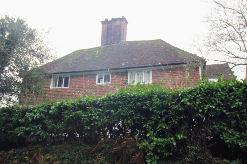
Pound Hill House
TQ 5827 39/476
II
2.
C17. Two storeys. Three windows. Ground floor painted brick, above tile-hung
tiled roof. Casement windows.
Listing NGR: TQ5893427022
External links are from the relevant listing authority and, where applicable, Wikidata. Wikidata IDs may be related buildings as well as this specific building. If you want to add or update a link, you will need to do so by editing the Wikidata entry.


Other nearby listed buildings
