Approximate Location Map
Large Map »
Latitude: 51.0567 / 51°3'24"N
Longitude: 0.2533 / 0°15'11"E
OS Eastings: 558014
OS Northings: 131015
OS Grid: TQ580310
Mapcode National: GBR MQQ.QVV
Mapcode Global: FRA C6FB.6HQ
Plus Code: 9F323743+M8
Entry Name: Mark House Farmhouse
Listing Date: 31 December 1982
Grade: II
Source: Historic England
Source ID: 1028135
English Heritage Legacy ID: 296637
ID on this website: 101028135
Location: Mark Cross, Wealden, East Sussex, TN6
County: East Sussex
District: Wealden
Civil Parish: Rotherfield
Traditional County: Sussex
Lieutenancy Area (Ceremonial County): East Sussex
Church of England Parish: Mark Cross St Mark
Church of England Diocese: Chichester
Tagged with: Farmhouse
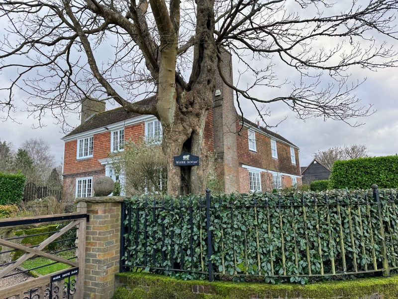
ROTHERFIELD MARK CROSS
1.
5208
Mark House Farmhouse
TQ 53 SE 14/243
II
2.
L-shaped C18 house. Two storeys. Three windows. Ground floor red brick and
grey headers, above tile-hung with modillion cornice of brick cogging between.
Eaves cornice. Tiled roof. Casement windows. Doorway with rectangular fanlight
and flat hood over.
Listing NGR: TQ5801431015
External links are from the relevant listing authority and, where applicable, Wikidata. Wikidata IDs may be related buildings as well as this specific building. If you want to add or update a link, you will need to do so by editing the Wikidata entry.


Other nearby listed buildings
