Approximate Location Map
Large Map »
Latitude: 51.049 / 51°2'56"N
Longitude: 0.2247 / 0°13'28"E
OS Eastings: 556035
OS Northings: 130094
OS Grid: TQ560300
Mapcode National: GBR MQW.3MK
Mapcode Global: FRA C6CB.TLJ
Plus Code: 9F3226XF+JV
Entry Name: Biddenden Farmhouse
Listing Date: 31 December 1982
Grade: II
Source: Historic England
Source ID: 1194118
English Heritage Legacy ID: 296661
ID on this website: 101194118
Location: Rotherfield, Wealden, East Sussex, TN6
County: East Sussex
District: Wealden
Civil Parish: Rotherfield
Built-Up Area: Town Row
Traditional County: Sussex
Lieutenancy Area (Ceremonial County): East Sussex
Church of England Parish: Rotherfield St Denys
Church of England Diocese: Chichester
Tagged with: Farmhouse
ROTHERFIELD STATION ROAD
1.
5208
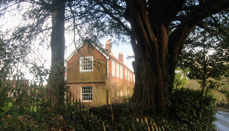
Biddenden Farmhouse
TQ 53 SE 14/232
II
2.
Early C19. Two storeys. Three windows. Ground floor red brick and grey headers,
above tile-hung. With modillion cornice between. Tiled roof. Glazing bars
intact. Doorway with flat hood and door of five moulded panels.
Listing NGR: TQ5603530094
External links are from the relevant listing authority and, where applicable, Wikidata. Wikidata IDs may be related buildings as well as this specific building. If you want to add or update a link, you will need to do so by editing the Wikidata entry.


Other nearby listed buildings
