Approximate Location Map
Large Map »
Latitude: 51.0759 / 51°4'33"N
Longitude: 0.3575 / 0°21'27"E
OS Eastings: 565247
OS Northings: 133378
OS Grid: TQ652333
Mapcode National: GBR NS0.F72
Mapcode Global: FRA C6M8.R47
Plus Code: 9F3239G5+92
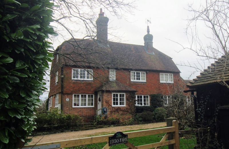
Entry Name: Lucks Farmhouse
Listing Date: 31 December 1982
Grade: II
Source: Historic England
Source ID: 1353634
English Heritage Legacy ID: 296761
ID on this website: 101353634
Location: Cousley Wood, Wealden, East Sussex, TN5
County: East Sussex
District: Wealden
Civil Parish: Wadhurst
Built-Up Area: Wadhurst
Traditional County: Sussex
Lieutenancy Area (Ceremonial County): East Sussex
Church of England Parish: Wadhurst St Peter and St Paul
Church of England Diocese: Chichester
Tagged with: Farmhouse
WADHURST COUSLEYWOOD
1.
5208
Lucks Farmhouse
TQ 63 SE 16/467
II
2.
C18 or earlier. Two storeys. Four windows. Ground floor red brick, above
tile-hung. Tiled roof. Casement windows. Modern porch.
Listing NGR: TQ6524733378
External links are from the relevant listing authority and, where applicable, Wikidata. Wikidata IDs may be related buildings as well as this specific building. If you want to add or update a link, you will need to do so by editing the Wikidata entry.


Other nearby listed buildings
