Approximate Location Map
Large Map »
Latitude: 51.0441 / 51°2'38"N
Longitude: 0.3349 / 0°20'5"E
OS Eastings: 563776
OS Northings: 129788
OS Grid: TQ637297
Mapcode National: GBR NSC.FHT
Mapcode Global: FRA C6LC.892
Plus Code: 9F3228VM+JX
Entry Name: Scrag Oak
Listing Date: 26 November 1953
Grade: II
Source: Historic England
Source ID: 1194791
English Heritage Legacy ID: 296827
ID on this website: 101194791
Location: Wealden, East Sussex, TN5
County: East Sussex
District: Wealden
Civil Parish: Wadhurst
Traditional County: Sussex
Lieutenancy Area (Ceremonial County): East Sussex
Church of England Parish: Wadhurst St Peter and St Paul
Church of England Diocese: Chichester
Tagged with: Architectural structure
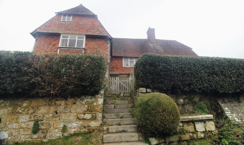
WADHURST SCRAG OAK
1.
5208
Scrag Oak
TQ 62 NW 22/449 26.11.53
II
2.
C16 or earlier timber-framed building now mostly refaced with red brick and
grey headers on ground floor and tile hung above. Tiled roof. Casement windows
with small square panes. Two storey three windows.
Listing NGR: TQ6377629788
External links are from the relevant listing authority and, where applicable, Wikidata. Wikidata IDs may be related buildings as well as this specific building. If you want to add or update a link, you will need to do so by editing the Wikidata entry.


Other nearby listed buildings
