Approximate Location Map
Large Map »
Latitude: 51.0439 / 51°2'38"N
Longitude: 0.335 / 0°20'5"E
OS Eastings: 563780
OS Northings: 129766
OS Grid: TQ637297
Mapcode National: GBR NSC.FHW
Mapcode Global: FRA C6LC.8B8
Plus Code: 9F3228VM+HX
Entry Name: Boundary Wall to the South East of Scrag Oak
Listing Date: 31 December 1982
Grade: II
Source: Historic England
Source ID: 1028086
English Heritage Legacy ID: 296828
ID on this website: 101028086
Location: Wealden, East Sussex, TN5
County: East Sussex
District: Wealden
Civil Parish: Wadhurst
Traditional County: Sussex
Lieutenancy Area (Ceremonial County): East Sussex
Church of England Parish: Wadhurst St Peter and St Paul
Church of England Diocese: Chichester
Tagged with: Wall
1.
5208
TQ 62 NW
22/449A
WADHURST
SCRAG OAK
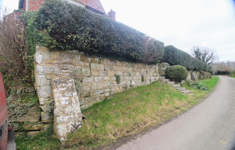
Boundary wall to the south east of Scrag Oak
II
2.
Dated 1674. Built of large blocks of stone and red brick with stone buttresses.
Listing NGR: TQ6378029766
External links are from the relevant listing authority and, where applicable, Wikidata. Wikidata IDs may be related buildings as well as this specific building. If you want to add or update a link, you will need to do so by editing the Wikidata entry.


Other nearby listed buildings
