Approximate Location Map
Large Map »
Latitude: 50.8534 / 50°51'12"N
Longitude: -0.5559 / 0°33'21"W
OS Eastings: 501745
OS Northings: 106981
OS Grid: TQ017069
Mapcode National: GBR FJ6.J7V
Mapcode Global: FRA 96QV.96N
Plus Code: 9C2XVC3V+9J
Entry Name: Wall on North Side of Garden to No 3
Listing Date: 7 October 1974
Grade: II
Source: Historic England
Source ID: 1027935
English Heritage Legacy ID: 297158
ID on this website: 101027935
Location: Arundel, Arun, West Sussex, BN18
County: West Sussex
District: Arun
Civil Parish: Arundel
Built-Up Area: Arundel
Traditional County: Sussex
Lieutenancy Area (Ceremonial County): West Sussex
Church of England Parish: Arundel St Nicholas with Tortington
Church of England Diocese: Chichester
Tagged with: Wall
1.
5401 BREWERY HILL
(East Side)
------------
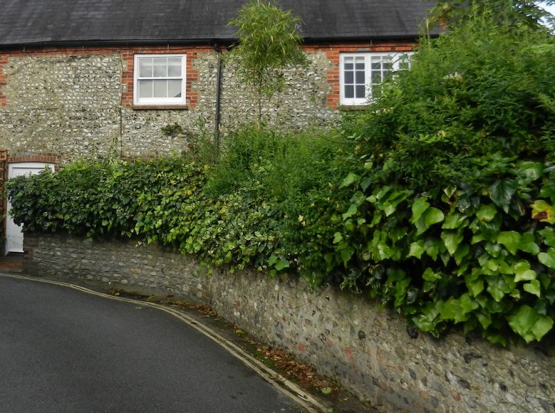
Wall on North side of
garden to No 3
TQ 0107 1/109
II GV
2.
Nodular flint, with red brick coping.
Nos 1 & 3 and wall to No 3 form a group.
Listing NGR: TQ0174406981
External links are from the relevant listing authority and, where applicable, Wikidata. Wikidata IDs may be related buildings as well as this specific building. If you want to add or update a link, you will need to do so by editing the Wikidata entry.


Other nearby listed buildings
