Approximate Location Map
Large Map »
Latitude: 50.855 / 50°51'17"N
Longitude: -0.5551 / 0°33'18"W
OS Eastings: 501803
OS Northings: 107159
OS Grid: TQ018071
Mapcode National: GBR FJ6.BGY
Mapcode Global: FRA 96QV.3L1
Plus Code: 9C2XVC3V+XX
Entry Name: 67, HIGH STREET (See details for further address information)
Listing Date: 26 March 1949
Grade: II
Source: Historic England
Source ID: 1353735
English Heritage Legacy ID: 297187
ID on this website: 101353735
Location: Arundel, Arun, West Sussex, BN18
County: West Sussex
District: Arun
Civil Parish: Arundel
Built-Up Area: Arundel
Traditional County: Sussex
Lieutenancy Area (Ceremonial County): West Sussex
Church of England Parish: Arundel St Nicholas with Tortington
Church of England Diocese: Chichester
Tagged with: Building
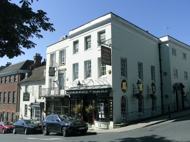
TQ 0107 ARUNDEL HIGH STREET
1/19 Number 67 and
1 Maltravers Street
26.3.49
II
House, now subdivided into house and restaurant. Early C19 altered in C20. Stuccoed with hipped slate roof Two or three storeys; 6 windows to Maltravers Street elevation. Moulded eaves cornice to 67 High Street. Left hand side of Maltravers Street elevation is of two storeys with three 12-pane sashes in reveals to first floor and three round-headed windows to ground floor. Right hand part is of three storeys and has irregularly spaced C20 casements. Centre C20 door with C20 Neo-Georgian wooden pediment and Ionic columns. No 1 has on right hand side a flight of steps leading to 6-panelled door with semi-circular fanlight and mid C19 moulded hood supported on brackets. Cast iron area railings with oval and curved lozenge design.
The following entry shall also be included:
TQ0107 ARUNDEL MALTRAVERS STREET
1/19 Number 1
26.3.49 II
See the entry for Number 67 HIGH STREET
Listing NGR: TQ0177207142
External links are from the relevant listing authority and, where applicable, Wikidata. Wikidata IDs may be related buildings as well as this specific building. If you want to add or update a link, you will need to do so by editing the Wikidata entry.


Other nearby listed buildings
