Approximate Location Map
Large Map »
Latitude: 50.8607 / 50°51'38"N
Longitude: -0.3097 / 0°18'34"W
OS Eastings: 519059
OS Northings: 108156
OS Grid: TQ190081
Mapcode National: GBR HM0.SND
Mapcode Global: FRA B67T.P5T
Plus Code: 9C2XVM6R+74
Entry Name: The Parish Church
Listing Date: 12 October 1954
Grade: I
Source: Historic England
Source ID: 1353728
English Heritage Legacy ID: 297249
ID on this website: 101353728
Location: Coombes, Adur, West Sussex, BN15
County: West Sussex
District: Adur
Civil Parish: Coombes
Traditional County: Sussex
Lieutenancy Area (Ceremonial County): West Sussex
Church of England Parish: Coombes
Church of England Diocese: Chichester
Tagged with: Church building Anglo-Saxon architecture
COOMBES COOMBES ROAD
TQ 10 NE
2/1
12.10.54 The Parish Church
I
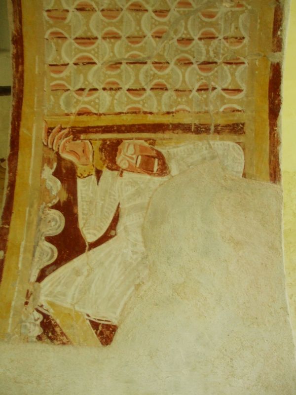
Dedication unknown. Flint walls with slate roof. Chancel, nave (shortened in 1724)
with tile-hung bell-turret at west end and south porch. Mainly Norman with C15
chancel windows. Wall-paintings of 1100 circa.
Listing NGR: TQ1905708159
External links are from the relevant listing authority and, where applicable, Wikidata. Wikidata IDs may be related buildings as well as this specific building. If you want to add or update a link, you will need to do so by editing the Wikidata entry.


Other nearby listed buildings
