Approximate Location Map
Large Map »
Latitude: 50.8138 / 50°48'49"N
Longitude: -0.5778 / 0°34'39"W
OS Eastings: 500293
OS Northings: 102551
OS Grid: TQ002025
Mapcode National: GBR FJK.YJ5
Mapcode Global: FRA 96PY.6RQ
Plus Code: 9C2XRC7C+GV
Entry Name: The Parish Church of St Mary
Listing Date: 5 June 1958
Grade: I
Source: Historic England
Source ID: 1027640
English Heritage Legacy ID: 297844
ID on this website: 101027640
Location: St Mary's Church, Climping, Arun, West Sussex, BN17
County: West Sussex
District: Arun
Civil Parish: Climping
Built-Up Area: Ford
Traditional County: Sussex
Lieutenancy Area (Ceremonial County): West Sussex
Church of England Parish: Clymping St Mary the Virgin
Church of England Diocese: Chichester
Tagged with: Church building
TW 00 SW CLIMPING FORD ROAD
16/351
5.6.58
The Parish Church of St
Mary
I
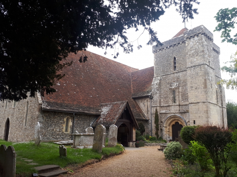
Cruciform building with tower to the south of the south transept, also a south porch.
The tower and the doorway to the west of it late C12, the remainder early C13.
Listing NGR: TQ0029202550
External links are from the relevant listing authority and, where applicable, Wikidata. Wikidata IDs may be related buildings as well as this specific building. If you want to add or update a link, you will need to do so by editing the Wikidata entry.


Other nearby listed buildings
