Approximate Location Map
Large Map »
Latitude: 50.7696 / 50°46'10"N
Longitude: -0.7474 / 0°44'50"W
OS Eastings: 488429
OS Northings: 97417
OS Grid: SZ884974
Mapcode National: GBR DHL.PVT
Mapcode Global: FRA 97B1.SSK
Plus Code: 9C2XQ793+R3
Entry Name: Becket's Barn
Listing Date: 5 June 1958
Last Amended: 20 September 1984
Grade: II
Source: Historic England
Source ID: 1234325
English Heritage Legacy ID: 297977
ID on this website: 101234325
Location: Pagham, Arun, West Sussex, PO21
County: West Sussex
District: Arun
Civil Parish: Pagham
Built-Up Area: Bognor Regis
Traditional County: Sussex
Lieutenancy Area (Ceremonial County): West Sussex
Church of England Parish: Pagham St Thomas a Becket
Church of England Diocese: Chichester
Tagged with: Barn
SZ 89 NE PAGHAM CHURCH LANE
20/487
5.6.58
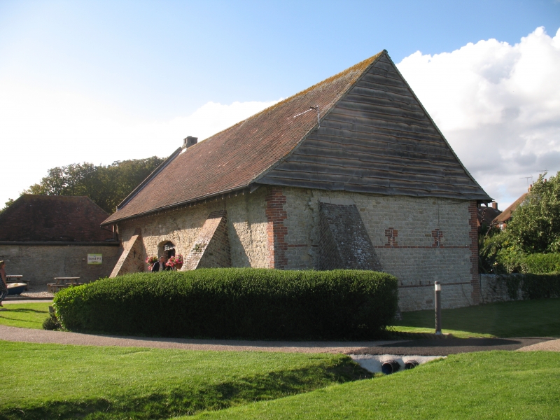
Becket's Barn (formerly
listed as Barn to south
east of the Church)
II
Medieval barn presumably once associated with the palace of the Archbishops of
Canterbury that was once situated here. Bognor stone rubble. Tiled roof. Gable at west
end.
Listing NGR: SZ8838897524
External links are from the relevant listing authority and, where applicable, Wikidata. Wikidata IDs may be related buildings as well as this specific building. If you want to add or update a link, you will need to do so by editing the Wikidata entry.


Other nearby listed buildings
