Approximate Location Map
Large Map »
Latitude: 50.8474 / 50°50'50"N
Longitude: -0.4565 / 0°27'23"W
OS Eastings: 508761
OS Northings: 106450
OS Grid: TQ087064
Mapcode National: GBR GKN.Z94
Mapcode Global: FRA 96YV.L0K
Plus Code: 9C2XRGWV+WC
Entry Name: 134, the Street
Listing Date: 20 September 1984
Grade: II
Source: Historic England
Source ID: 1027586
English Heritage Legacy ID: 298018
ID on this website: 101027586
Location: Patching, Arun, West Sussex, BN13
County: West Sussex
District: Arun
Civil Parish: Patching
Traditional County: Sussex
Lieutenancy Area (Ceremonial County): West Sussex
Church of England Parish: Findon, Clapham and Patching
Church of England Diocese: Chichester
Tagged with: Building Thatched building
TQ 00 NE
10/50
PATCHING
THE STREET
(east side)
No 134
II
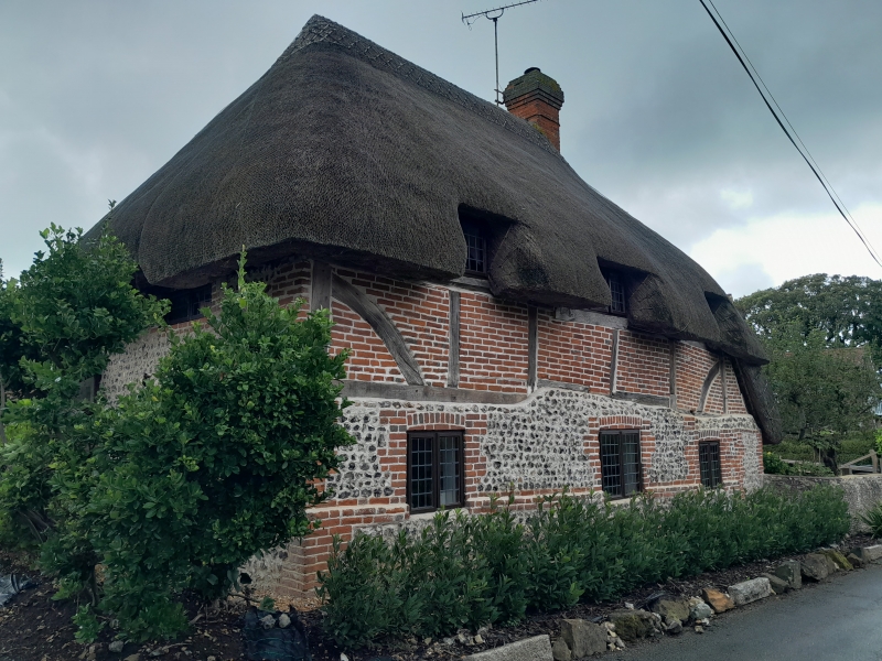
C17 or earlier timber-framed building with red brick infilling, ground floor rebuilt
in brick and flints. Hipped thatched roof with three "eyebrows" and pentice to
south. Casement windows. Two storeys. Three windows.
Listing NGR: TQ0876106450
External links are from the relevant listing authority and, where applicable, Wikidata. Wikidata IDs may be related buildings as well as this specific building. If you want to add or update a link, you will need to do so by editing the Wikidata entry.


Other nearby listed buildings
