Approximate Location Map
Large Map »
Latitude: 50.8321 / 50°49'55"N
Longitude: -0.5156 / 0°30'56"W
OS Eastings: 504632
OS Northings: 104668
OS Grid: TQ046046
Mapcode National: GBR GKS.NH6
Mapcode Global: FRA 96TW.T4G
Plus Code: 9C2XRFJM+RQ
Entry Name: The Manor House
Listing Date: 12 October 1954
Grade: II
Source: Historic England
Source ID: 1353891
English Heritage Legacy ID: 298022
ID on this website: 101353891
Location: Poling, Arun, West Sussex, BN18
County: West Sussex
District: Arun
Civil Parish: Poling
Traditional County: Sussex
Lieutenancy Area (Ceremonial County): West Sussex
Church of England Parish: Poling
Church of England Diocese: Chichester
Tagged with: House
TQ 00 SW POLING POLING STREET
16/173
12.10.54
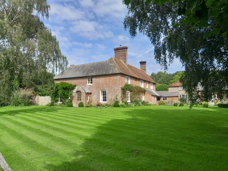
The Manor House
II
Once called Church Farm. L-shaped building. North east wing C18, south west wing
early C19. Two storeys. Four windows facing east, three windows facing south. Red
brick and grey headers. Stringcourse. Tiled roof, the south faced with slates.
Glazing bars intact. The south front has a porch with shaped gable.
Listing NGR: TQ0463204668
External links are from the relevant listing authority and, where applicable, Wikidata. Wikidata IDs may be related buildings as well as this specific building. If you want to add or update a link, you will need to do so by editing the Wikidata entry.


Other nearby listed buildings
