Approximate Location Map
Large Map »
Latitude: 50.8671 / 50°52'1"N
Longitude: -0.6352 / 0°38'6"W
OS Eastings: 496139
OS Northings: 108397
OS Grid: SU961083
Mapcode National: GBR FHX.G7K
Mapcode Global: FRA 96KT.2CR
Plus Code: 9C2XV987+RW
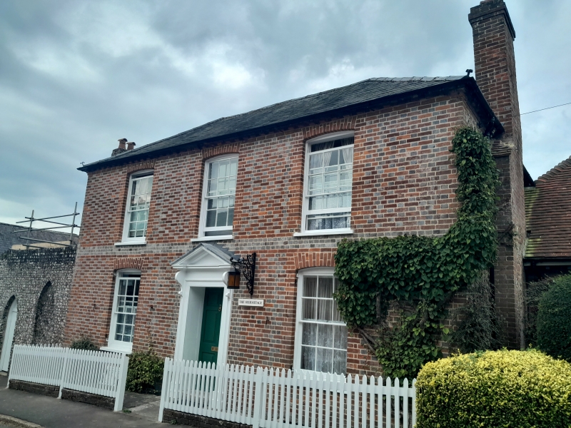
Entry Name: The Hermitage
Listing Date: 20 September 1984
Grade: II
Source: Historic England
Source ID: 1221607
English Heritage Legacy ID: 298068
ID on this website: 101221607
Location: Slindon, Arun, West Sussex, BN18
County: West Sussex
District: Arun
Civil Parish: Slindon
Built-Up Area: Slindon
Traditional County: Sussex
Lieutenancy Area (Ceremonial County): West Sussex
Church of England Parish: Slindon St Mary
Church of England Diocese: Chichester
Tagged with: Architectural structure
SU 9608 SLINDON CHURCH HILL
22/274 (west side)
The Hermitage
II
Early C19. Two storeys. Three windows. Red brick and grey headers. Modillion
eaves. Slate roof. Glazing bars intact. Doorway with pilasters and pediment over on
brackets.
Listing NGR: SU9613208406
External links are from the relevant listing authority and, where applicable, Wikidata. Wikidata IDs may be related buildings as well as this specific building. If you want to add or update a link, you will need to do so by editing the Wikidata entry.


Other nearby listed buildings
