Approximate Location Map
Large Map »
Latitude: 51.0645 / 51°3'52"N
Longitude: -0.3349 / 0°20'5"W
OS Eastings: 516774
OS Northings: 130785
OS Grid: TQ167307
Mapcode National: GBR HJN.05G
Mapcode Global: FRA B659.RC9
Plus Code: 9C3X3M78+R2
Entry Name: The King's Arms
Listing Date: 26 July 1974
Grade: II
Source: Historic England
Source ID: 1353921
English Heritage Legacy ID: 298088
ID on this website: 101353921
Location: Horsham, West Sussex, RH12
County: West Sussex
District: Horsham
Electoral Ward/Division: Trafalgar
Parish: Non Civil Parish
Built-Up Area: Horsham
Traditional County: Sussex
Lieutenancy Area (Ceremonial County): West Sussex
Church of England Parish: Horsham St Mary the Virgin
Church of England Diocese: Chichester
Tagged with: Pub
BISHOPRIC ROAD
1.
1236
(North Side)
No 64
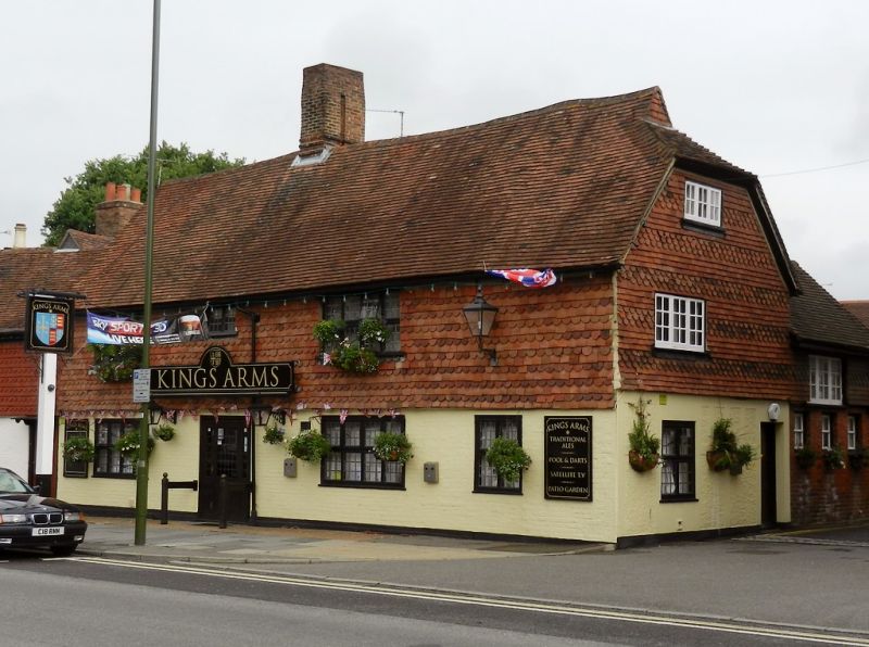
(The King's Arms)
TQ 1630 1/63
II GV
2.
Late C17 or early C18. 2 storeys. 3 windows. Timber-framed. Half-hipped tile
roof with louvred gablet (now blocked) to the right. Upper storey hung with fish-scale
tiles. Painted brick below. Modern windows.
Nos 64 to 70 (even) form a group.
Listing NGR: TQ1677430785
External links are from the relevant listing authority and, where applicable, Wikidata. Wikidata IDs may be related buildings as well as this specific building. If you want to add or update a link, you will need to do so by editing the Wikidata entry.


Other nearby listed buildings
