Approximate Location Map
Large Map »
Latitude: 50.9067 / 50°54'24"N
Longitude: -0.5342 / 0°32'3"W
OS Eastings: 503156
OS Northings: 112940
OS Grid: TQ031129
Mapcode National: GBR GJZ.3RG
Mapcode Global: FRA 96RQ.5NZ
Plus Code: 9C2XWF48+M8
Entry Name: Lyndhurst
Listing Date: 9 May 1980
Grade: II
Source: Historic England
Source ID: 1027483
English Heritage Legacy ID: 298283
ID on this website: 101027483
Location: Amberley, Horsham, West Sussex, BN18
County: West Sussex
District: Horsham
Civil Parish: Amberley
Built-Up Area: Amberley
Traditional County: Sussex
Lieutenancy Area (Ceremonial County): West Sussex
Church of England Parish: Amberley with North Stoke
Church of England Diocese: Chichester
Tagged with: Building
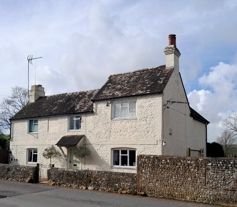
AMBERLEY SCHOOL ROAD
1. (west side)
5404
Lyndhurst
TQ 01 SW 10/677
II
2.
Early Cl9. Two storeys. Three windows. Stone rubble with red brick stringcourse
and modillion eaves cornice, all washed. Northernmost window-bays has higher
elevation than the remainder. Tiled roof. Casement windows.
Listing NGR: TQ0315612940
External links are from the relevant listing authority and, where applicable, Wikidata. Wikidata IDs may be related buildings as well as this specific building. If you want to add or update a link, you will need to do so by editing the Wikidata entry.


Other nearby listed buildings
