Approximate Location Map
Large Map »
Latitude: 50.8829 / 50°52'58"N
Longitude: -0.3153 / 0°18'55"W
OS Eastings: 518608
OS Northings: 110622
OS Grid: TQ186106
Mapcode National: GBR HLS.K36
Mapcode Global: FRA B67R.T5T
Plus Code: 9C2XVMMM+5V
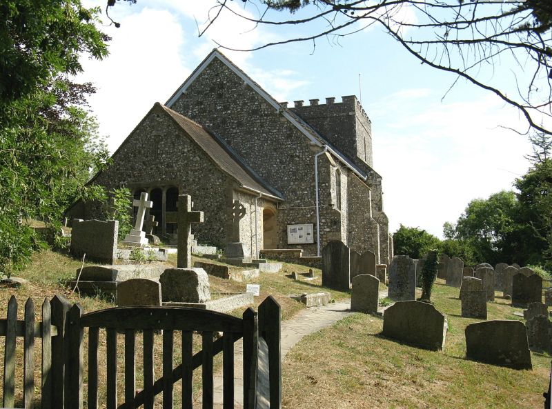
Entry Name: The Parish Church of St Nicholas
Listing Date: 15 March 1955
Grade: I
Source: Historic England
Source ID: 1353947
English Heritage Legacy ID: 298337
ID on this website: 101353947
Location: St Nicholas's Church, Bramber, Horsham, West Sussex, BN44
County: West Sussex
District: Horsham
Civil Parish: Bramber
Built-Up Area: Upper Beeding
Traditional County: Sussex
Lieutenancy Area (Ceremonial County): West Sussex
Church of England Parish: Beeding St Peter and Bramber St Nicholas
Church of England Diocese: Chichester
Tagged with: Church building
BRAMBER THE STREET
1. (north side)
5404
The Parish Church of
St Nicholas
TQ 1810 25/45 15.3.55
I
2.
Chancel with east tower over it, nave and west vestry.
Originally cruciform. Largely Norman. The tower is hollow and dates from
the C18. Vestry C20.
Listing NGR: TQ1861210624
External links are from the relevant listing authority and, where applicable, Wikidata. Wikidata IDs may be related buildings as well as this specific building. If you want to add or update a link, you will need to do so by editing the Wikidata entry.


Other nearby listed buildings
