Approximate Location Map
Large Map »
Latitude: 50.9165 / 50°54'59"N
Longitude: -0.494 / 0°29'38"W
OS Eastings: 505958
OS Northings: 114081
OS Grid: TQ059140
Mapcode National: GBR GJV.FWV
Mapcode Global: FRA 96VP.9CB
Plus Code: 9C2XWG84+H9
Entry Name: The Parish Church of St Peter
Listing Date: 15 March 1955
Grade: I
Source: Historic England
Source ID: 1027354
English Heritage Legacy ID: 298495
ID on this website: 101027354
Location: St Peter's Church, Horsham, West Sussex, RH20
County: West Sussex
District: Horsham
Civil Parish: Parham
Traditional County: Sussex
Lieutenancy Area (Ceremonial County): West Sussex
Church of England Parish: Parham St Peter
Church of England Diocese: Chichester
Tagged with: Church building
PARHAM PARHAM
1.
5404
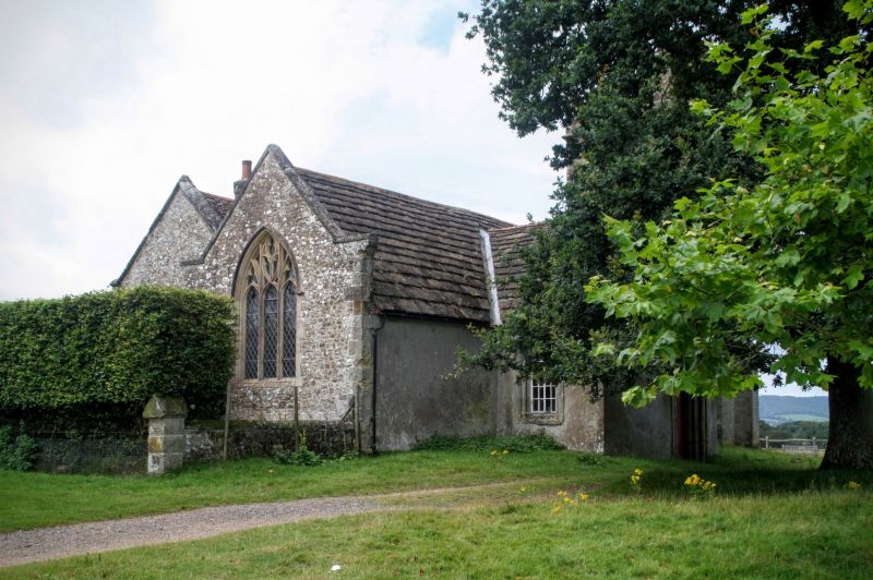
The Parish Church
of St Peter
TQ 01 SE 11/576 15.3.55
I
2.
Cruciform building consisting of chancel, south chapel, north transept or family
pew, nave and west tower. Tower C15, south chapel, C16. Remainder mostly 1800.
Horsham slab roof. Box-pens inside.
Listing NGR: TQ0596314080
External links are from the relevant listing authority and, where applicable, Wikidata. Wikidata IDs may be related buildings as well as this specific building. If you want to add or update a link, you will need to do so by editing the Wikidata entry.


Other nearby listed buildings
