Approximate Location Map
Large Map »
Latitude: 50.9748 / 50°58'29"N
Longitude: -0.5186 / 0°31'6"W
OS Eastings: 504104
OS Northings: 120537
OS Grid: TQ041205
Mapcode National: GBR GJ1.V05
Mapcode Global: FRA 96SJ.RSP
Plus Code: 9C2XXFFJ+WH
Entry Name: Oak House Farmhouse
Listing Date: 9 May 1980
Grade: II
Source: Historic England
Source ID: 1027333
English Heritage Legacy ID: 298547
ID on this website: 101027333
Location: Pickhurst, Horsham, West Sussex, RH20
County: West Sussex
District: Horsham
Civil Parish: Pulborough
Traditional County: Sussex
Lieutenancy Area (Ceremonial County): West Sussex
Church of England Parish: Pulborough St Mary
Church of England Diocese: Chichester
Tagged with: Farmhouse
PULBOROUGH COOMBELANDS LANE
1.
5404
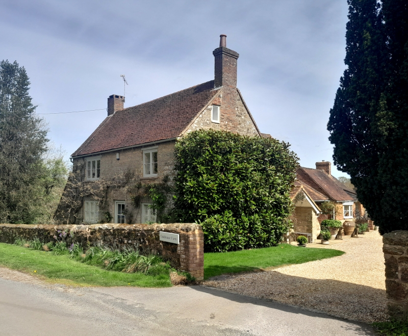
Oak House Farmhouse
TQ 02 SW 1/787
II
2.
Front portion C18. Two storeys. Three windows. Ashlar. Hipped tiled roof. Casement
windows. Door of six fielded panels. Older portion behind.
Listing NGR: TQ0410420537
External links are from the relevant listing authority and, where applicable, Wikidata. Wikidata IDs may be related buildings as well as this specific building. If you want to add or update a link, you will need to do so by editing the Wikidata entry.


Other nearby listed buildings
