Approximate Location Map
Large Map »
Latitude: 50.9575 / 50°57'27"N
Longitude: -0.5019 / 0°30'6"W
OS Eastings: 505316
OS Northings: 118632
OS Grid: TQ053186
Mapcode National: GBR GJ7.ZY1
Mapcode Global: FRA 96VL.0B3
Plus Code: 9C2XXF5X+27
Entry Name: 50 Lower Street
Listing Date: 9 May 1980
Grade: II
Source: Historic England
Source ID: 1027348
English Heritage Legacy ID: 298580
ID on this website: 101027348
Location: Pulborough, Horsham, West Sussex, RH20
County: West Sussex
District: Horsham
Civil Parish: Pulborough
Built-Up Area: West Chiltington Common
Traditional County: Sussex
Lieutenancy Area (Ceremonial County): West Sussex
Church of England Parish: Pulborough St Mary
Church of England Diocese: Chichester
Tagged with: Building
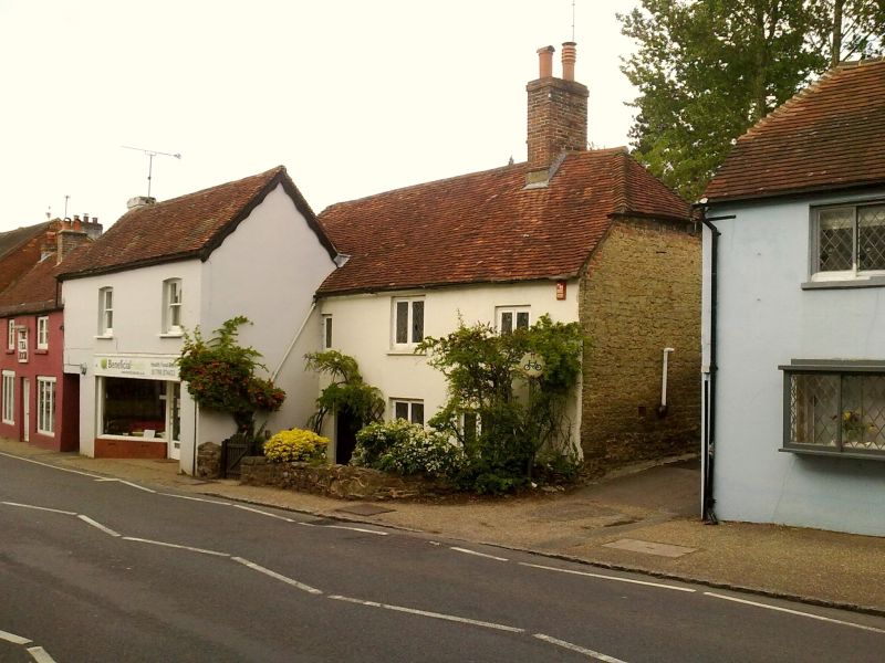
PULBOROUGH LOWER STREET (north side)
1.
5404
No 50
TQ 0518 17/717
II
2.
C17. Two storeys. Two windows. Now faced with stucco. Half-hipped tiled roof.
Casement windows. (No 48 has been built out in front of the west end).
Listing NGR: TQ0531618632
External links are from the relevant listing authority and, where applicable, Wikidata. Wikidata IDs may be related buildings as well as this specific building. If you want to add or update a link, you will need to do so by editing the Wikidata entry.


Other nearby listed buildings
