Approximate Location Map
Large Map »
Latitude: 50.9556 / 50°57'20"N
Longitude: -0.5347 / 0°32'4"W
OS Eastings: 503016
OS Northings: 118371
OS Grid: TQ030183
Mapcode National: GBR GJD.3MT
Mapcode Global: FRA 96RL.CHC
Plus Code: 9C2XXF48+64
Entry Name: The White Hart Public House
Listing Date: 9 May 1980
Grade: II
Source: Historic England
Source ID: 1027310
English Heritage Legacy ID: 298596
Also known as: White Hart, Pulborough
White Hart
ID on this website: 101027310
PULBOROUGH PETWORTH ROAD
1.
5404
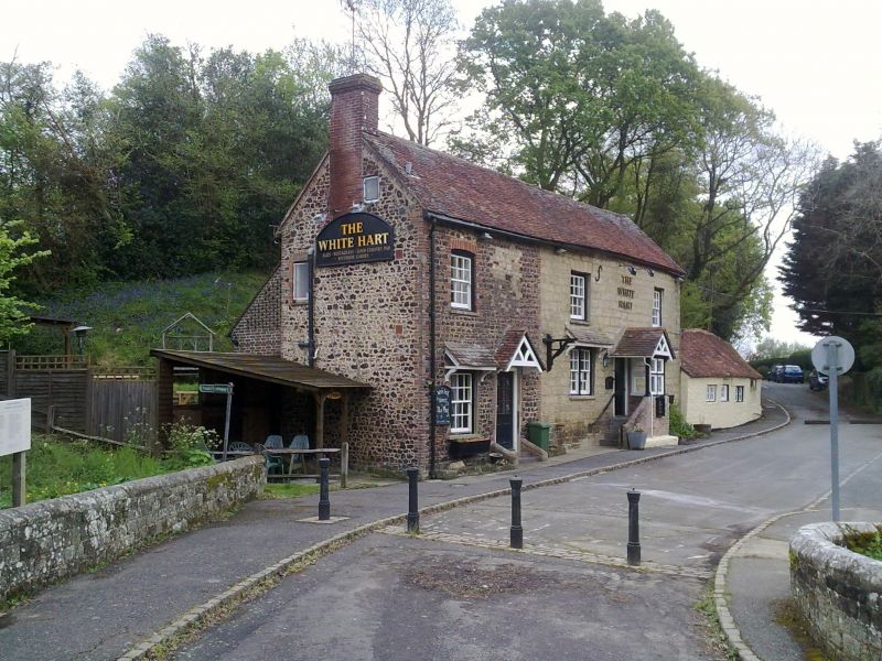
The White Hart
Public House
TQ 01 NW 5/783
II
2.
C18. Two storeys. Three windows. Carstone and Hythe sandstone ashlar, westernmost window-bay ironstone rubble. Tiled roof. Glazing bars intact. Two doorways with C19 gabled hoods, eastern one converted into a porch.
Listing NGR: TQ0301618371
External links are from the relevant listing authority and, where applicable, Wikidata. Wikidata IDs may be related buildings as well as this specific building. If you want to add or update a link, you will need to do so by editing the Wikidata entry.


Other nearby listed buildings
