Approximate Location Map
Large Map »
Latitude: 50.9571 / 50°57'25"N
Longitude: -0.4833 / 0°28'59"W
OS Eastings: 506622
OS Northings: 118618
OS Grid: TQ066186
Mapcode National: GBR GJ8.YDD
Mapcode Global: FRA 96WL.1JV
Plus Code: 9C2XXG48+VM
Entry Name: West Mare
Listing Date: 9 May 1980
Grade: II
Source: Historic England
Source ID: 1354040
English Heritage Legacy ID: 298632
ID on this website: 101354040
Location: Marehill, Horsham, West Sussex, RH20
County: West Sussex
District: Horsham
Civil Parish: Pulborough
Built-Up Area: West Chiltington Common
Traditional County: Sussex
Lieutenancy Area (Ceremonial County): West Sussex
Church of England Parish: Pulborough St Mary
Church of England Diocese: Chichester
Tagged with: Architectural structure
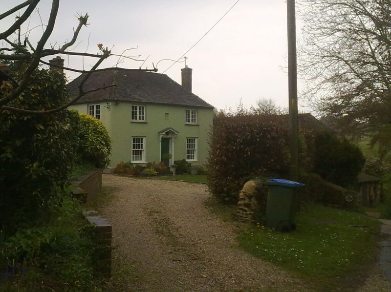
PULBOROUGH WEST MARE LANE
1.
5404
Mare Hill
West Mare
TQ 01 NE 6/758
II
2.
Dated 1734. Two storeys. Two windows. Stuccoed. Hipped tiled roof. Sash windows
with glazing bars intact on ground floor, casement windows above. Modern Georgian
doorway. Date-stone above with date 1734 and the initials J T.
Listing NGR: TQ0662218618
External links are from the relevant listing authority and, where applicable, Wikidata. Wikidata IDs may be related buildings as well as this specific building. If you want to add or update a link, you will need to do so by editing the Wikidata entry.


Other nearby listed buildings
