Approximate Location Map
Large Map »
Latitude: 50.9719 / 50°58'18"N
Longitude: -0.2584 / 0°15'30"W
OS Eastings: 522373
OS Northings: 120607
OS Grid: TQ223206
Mapcode National: GBR JM1.TR5
Mapcode Global: FRA B6BJ.YZF
Plus Code: 9C2XXPCR+QJ
Entry Name: Park Farmhouse
Listing Date: 9 May 1980
Grade: II
Source: Historic England
Source ID: 1285831
English Heritage Legacy ID: 298644
ID on this website: 101285831
Location: Kent Street, Horsham, West Sussex, RH13
County: West Sussex
District: Horsham
Civil Parish: Shermanbury
Traditional County: Sussex
Lieutenancy Area (Ceremonial County): West Sussex
Church of England Parish: Shermanbury St Giles
Church of England Diocese: Chichester
Tagged with: Farmhouse
SHERMANBURY BUCKHATCH LANE
1.
5404
Wineham
Park Farmhouse
TQ 22 SW 4/335
II
2.
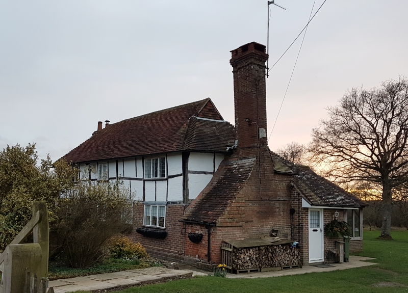
C17 or earlier timber-framed building, ground floor rebuilt in red brick. Tiled roof.
Casement windows. Chimney breast on north wall. Two storeys. Three windows.
Listing NGR: TQ2237320607
External links are from the relevant listing authority and, where applicable, Wikidata. Wikidata IDs may be related buildings as well as this specific building. If you want to add or update a link, you will need to do so by editing the Wikidata entry.


Other nearby listed buildings
