Approximate Location Map
Large Map »
Latitude: 50.8884 / 50°53'18"N
Longitude: -0.3274 / 0°19'38"W
OS Eastings: 517744
OS Northings: 111212
OS Grid: TQ177112
Mapcode National: GBR HLS.818
Mapcode Global: FRA B66R.G96
Plus Code: 9C2XVMQF+92
Entry Name: 11, Church Street
Listing Date: 15 March 1955
Grade: II
Source: Historic England
Source ID: 1027300
English Heritage Legacy ID: 298668
ID on this website: 101027300
Location: Steyning, Horsham, West Sussex, BN44
County: West Sussex
District: Horsham
Civil Parish: Steyning
Built-Up Area: Steyning
Traditional County: Sussex
Lieutenancy Area (Ceremonial County): West Sussex
Church of England Parish: Steyning St Andrew
Church of England Diocese: Chichester
Tagged with: Building
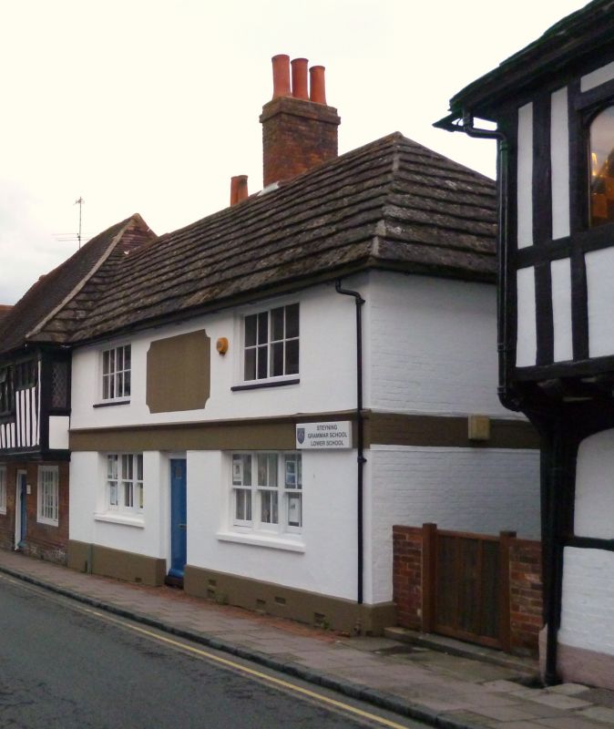
STEYNING CHURCH STREET
1. (south-east side)
5404
No 11
TQ 1711 24/63 15.3.55
II GV
2.
Formerly the Smugglers Arms Inn, now the Bursars office of the Grammar School.
Medieval timber-framed hall house, refaced with cement, south-west side red brick,
now painted. Stringcourse. Horsham slab roof. Modern windows. Two storeys.
Two windows.
Listing NGR: TQ1774411212
External links are from the relevant listing authority and, where applicable, Wikidata. Wikidata IDs may be related buildings as well as this specific building. If you want to add or update a link, you will need to do so by editing the Wikidata entry.


Other nearby listed buildings
