Approximate Location Map
Large Map »
Latitude: 50.8891 / 50°53'20"N
Longitude: -0.3298 / 0°19'47"W
OS Eastings: 517569
OS Northings: 111286
OS Grid: TQ175112
Mapcode National: GBR HLS.1G5
Mapcode Global: FRA B66R.F9Z
Plus Code: 9C2XVMQC+J3
Entry Name: 74, High Street
Listing Date: 12 August 1969
Grade: II
Source: Historic England
Source ID: 1027276
English Heritage Legacy ID: 298711
ID on this website: 101027276
Location: Steyning, Horsham, West Sussex, BN44
County: West Sussex
District: Horsham
Civil Parish: Steyning
Built-Up Area: Steyning
Traditional County: Sussex
Lieutenancy Area (Ceremonial County): West Sussex
Church of England Parish: Steyning St Andrew
Church of England Diocese: Chichester
Tagged with: Building
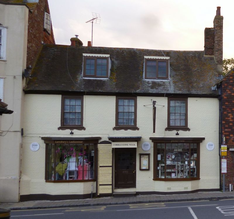
STEYNING HIGH STREET
1. (north-east side)
5404
No 74
TQ 1711 24/106 12.8.69
II GV
2.
Early C19. Two storeys. Three windows. Painted brick. Eaves cornice. Tiled
roof. Glazing bars intact. Two large bays on ground floor. Doorway between
with flat hood and rectangular fanlight.
Listing NGR: TQ1756911286
External links are from the relevant listing authority and, where applicable, Wikidata. Wikidata IDs may be related buildings as well as this specific building. If you want to add or update a link, you will need to do so by editing the Wikidata entry.


Other nearby listed buildings
