Approximate Location Map
Large Map »
Latitude: 50.8904 / 50°53'25"N
Longitude: -0.3318 / 0°19'54"W
OS Eastings: 517429
OS Northings: 111427
OS Grid: TQ174114
Mapcode National: GBR HLS.0Y2
Mapcode Global: FRA B66R.6L5
Plus Code: 9C2XVMR9+57
Entry Name: 124, High Street
Listing Date: 9 May 1980
Grade: II
Source: Historic England
Source ID: 1285441
English Heritage Legacy ID: 298719
ID on this website: 101285441
Location: Steyning, Horsham, West Sussex, BN44
County: West Sussex
District: Horsham
Civil Parish: Steyning
Built-Up Area: Steyning
Traditional County: Sussex
Lieutenancy Area (Ceremonial County): West Sussex
Church of England Parish: Steyning St Andrew
Church of England Diocese: Chichester
Tagged with: Building
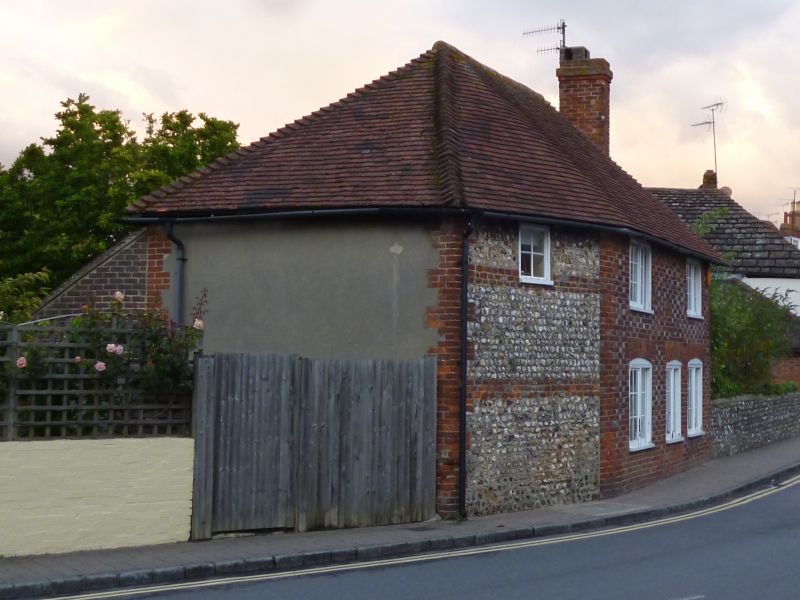
STEYNING HIGH STREET
1. (north-east side)
5404
No 124
TQ 1711 24/114
II GV
2.
Early C19. Two storeys. Three windows. The facade has a slight bend in
it. Southern two thirds red brick and grey headers, northern third flints
with red brick dressings, quoins and two stringcourses. Hipped tiled roof.
Casement windows.
Listing NGR: TQ1742911427
External links are from the relevant listing authority and, where applicable, Wikidata. Wikidata IDs may be related buildings as well as this specific building. If you want to add or update a link, you will need to do so by editing the Wikidata entry.


Other nearby listed buildings
