Approximate Location Map
Large Map »
Latitude: 50.8882 / 50°53'17"N
Longitude: -0.3293 / 0°19'45"W
OS Eastings: 517607
OS Northings: 111190
OS Grid: TQ176111
Mapcode National: GBR HLS.7KS
Mapcode Global: FRA B66R.FHV
Plus Code: 9C2XVMQC+77
Entry Name: Lloyds Bank
Listing Date: 9 May 1980
Grade: II
Source: Historic England
Source ID: 1180546
English Heritage Legacy ID: 298741
ID on this website: 101180546
Location: Steyning, Horsham, West Sussex, BN44
County: West Sussex
District: Horsham
Civil Parish: Steyning
Built-Up Area: Steyning
Traditional County: Sussex
Lieutenancy Area (Ceremonial County): West Sussex
Church of England Parish: Steyning St Andrew
Church of England Diocese: Chichester
Tagged with: Bank building
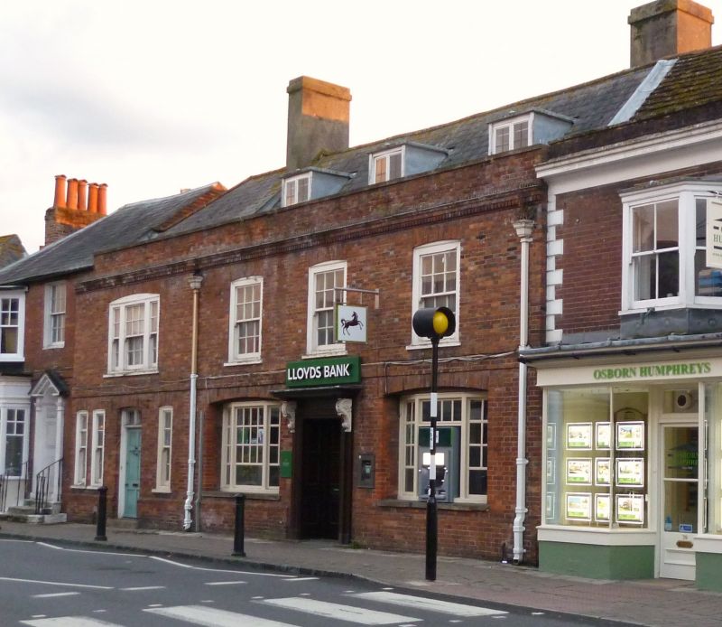
STEYNING HIGH STREET
1. (south-west side)
5404
No 37 (Lloyds Bank)
TQ 1711 24/136
II GV
2.
C18. Two storeys and attic. Four windows. Three dormers. Red brick. Stringcourse,
dentilled cornice and parapet. Slate roof. Glazing bars intact on first floor
only. Modern windows below.
Listing NGR: TQ1760711190
External links are from the relevant listing authority and, where applicable, Wikidata. Wikidata IDs may be related buildings as well as this specific building. If you want to add or update a link, you will need to do so by editing the Wikidata entry.


Other nearby listed buildings
