Approximate Location Map
Large Map »
Latitude: 50.8824 / 50°52'56"N
Longitude: -0.3052 / 0°18'18"W
OS Eastings: 519318
OS Northings: 110578
OS Grid: TQ193105
Mapcode National: GBR HLT.MMV
Mapcode Global: FRA B67R.YQT
Plus Code: 9C2XVMJV+XW
Entry Name: Manor Cottage
Listing Date: 9 May 1980
Grade: II
Source: Historic England
Source ID: 1284969
English Heritage Legacy ID: 298886
ID on this website: 101284969
Location: Upper Beeding, Horsham, West Sussex, BN44
County: West Sussex
District: Horsham
Civil Parish: Upper Beeding
Built-Up Area: Upper Beeding
Traditional County: Sussex
Lieutenancy Area (Ceremonial County): West Sussex
Church of England Parish: Beeding St Peter and Bramber St Nicholas
Church of England Diocese: Chichester
Tagged with: Cottage
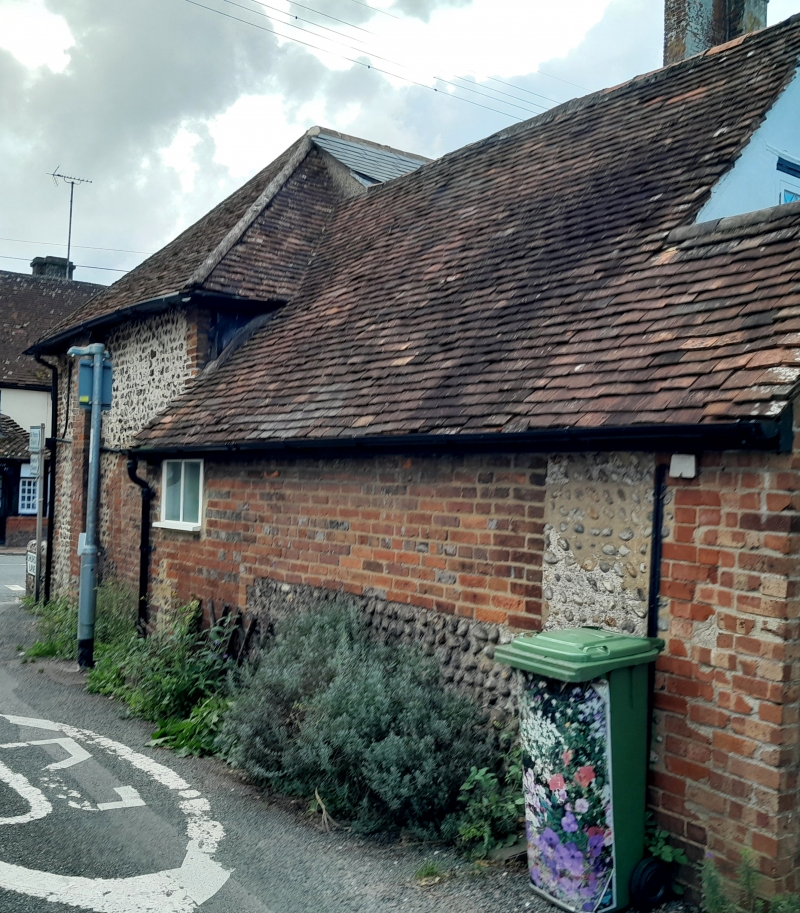
UPPER BEEDING HIGH STREET
1. (north side)
5404
Manor Cottage
TQ 1910 25/8
II
2.
C17 or earlier. Two storeys. Two windows. Faced with flints with red brick
quoins. Tiled roof. Modern casement windows with continuous tiled hood over
those on ground floor.
Listing NGR: TQ1931810578
External links are from the relevant listing authority and, where applicable, Wikidata. Wikidata IDs may be related buildings as well as this specific building. If you want to add or update a link, you will need to do so by editing the Wikidata entry.


Other nearby listed buildings
